UNOSAT is a technology-intensive programme under the United Nations Institute for Training and Research (UNITAR) implemented with the support of the European Organization for Nuclear Research (CERN) and in partnership with UN and non-UN organizations. Its Humanitarian Rapid Mapping Service is delivering imagery analysis and satellite solutions to relief and development organizations within and outside the UN system to help make a difference in critical areas such as humanitarian relief, human security, strategic territorial and development planning. UNOSAT develops solutions keeping in sight the needs of the beneficiaries at the end of the process. On average, UNOSAT is requested to analyse satellite images to support emergency response and complex emergencies 35 times each year.
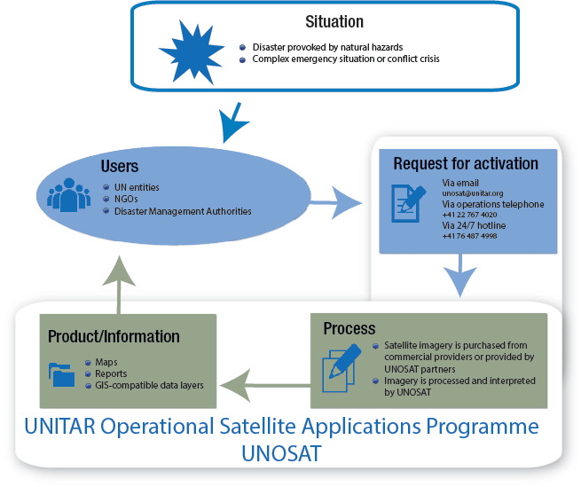
Users
Entities of the United Nations systems such as OCHA, UNHCR, UNICEF, WFP, UNDP, WHO, IFRC, ICRC; International and national NGOs and the Governments of affected countries.
Conditions for Activation
The activation of the UNOSAT mechanism can be requested in the case of disasters provoked by natural hazards, complex emergency situations or conflict crises. The services involve very rapid acquisition and processing of satellite imagery to generate geospatial information and analytical reports in addition to GIS layers in support of humanitarian relief agencies.
Request/Point of Contact
UNOSAT can be contacted for support via email (unosat [at] unitar.org), via the operations telephone line (+41 22 767 4020) or the 24/7 hotline (+41 76 487 4998).
Process
The imagery is purchased by UNOSAT from commercial providers or provided as in-kind support to UNOSAT from Space Agencies which are members of the International Charter Space and Major Disasters as well as from the US Department of State. The imagery is then processed by UNOSAT.
Products/Information
UNOSAT provides maps, reports as well as GIS compatible data layers at no cost to the user. UNOSAT products are also shared with the humanitarian cluster system coordinated by OCHA. The Shelter cluster even benefits from a dedicated web-supported platform named REACH, created by UNOSAT and its NGO Partner “Impact Initiatives” to improve rapid assessment after conflict and disasters.