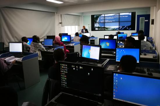
The International Training Course on Integration of Multisource Earth Observation Data for Disaster Damage Assessment was successfully organized from 25 to 31 October in Beijing, China. The training programme was conducted back to back with the United Nations International Conference on Space-based Technologies for Disaster Risk Reduction - “Building Resilience through Integrated Applications” organized by the United Nations Office for Outer Space Affairs (UNOOSA), under the framework of UN-SPIDER, and the Ministry of Civil Affairs of the People’s Republic of China in Beijing, China from 23 to 25 October 2017.
The training programme organised jointly with the Asia Pacific Space Cooperation Organisation (APSCO) and National Disaster Reduction Centre of China (NDRCC). The training programme was hosted in the Regional Centre for Space Science Technology Education in Asia and the Pacific (RCSSTEAP) based in Beihang University, Beijing and experts from UNOOSA/UN-SPIDER, NDRCC, Centre for Space Science and Technology Education for Asia and the Pacific (CSSTEAP) based in India, and RCSSTEAP based in Beihang University contributed to this hands-on training programme.
The aim of the training was to make participants conversant with use of Multi-source Earth Observation (including satellite and UAV, optical and microwave data, remote sensing and Geographical Information System, 3D modeling and other geospatial technology) in flood and earthquake damage assessment in particular. The training resulted in imparting skills to identify damaged infrastructure and learn about the methodology of damage assessment using integrated Multi-source Earth Observation technology.
Following sessions (including hands on exercises) were offered during the training:
- Session 1: Basic Concepts of Remote Sensing and GIS and Chinese Open-source Space Data and Products
- Session 2: Theory and Practice on Direct Tangible Damage Assessment Caused by Earthquake
- Session 3: Theory and Practice on Flood Extent Mapping and Direct Tangible Damage Assessment
- Session 4: UAV Image Processing
- Session 5: Basic Concepts of DRR and Multisource Earth Observation Data for Earthquake Damage Assessment
- Session 6: Multisource Earth Observation Data for Flood Damage Assessment
- Session 7: Digital Analysis for Rapid Damage Assessment
- Session 8: Basic Concepts of GIS and Creation of GIS Database
- Session 9: 3D Modeling and Current Trends for Rapid Damage Assessment
These sessions covered the following specific topics:
Basic Concepts of Remote Sensing and GIS, Creation of GIS Database (Spatial, Non-spatial Data Handling and Spatial Analysis), Disaster Risk Reduction (DRR) Basic Concepts and Overview & EO Data for DRR and Mitigation, Chinese Open-source Space Data and Products, Earthquake Emergency Response Mapping- Basic Concepts and Applications, Earthquake Secondary Disaster Identification and Roads Damage Assessment Using High Resolution Images, Flood Extent Mapping and Direct Tangible Damage Assessment, Building Damage Assessment Caused by Flood, Theory and Practice on UAV Image Processing, Earth Observation Data for Earthquake Induced Damage Assessment, Integration of Multisource Earth Observation Data for Flood Monitoring and Emergency Response, Familiarization with Multisource EO Data for Flood Disaster, Flood Inundation Mapping & Damage Assessment Using Sentinel-1 SAR Data, Digital Image Analysis for Earthquake Related Damage Assessment, EO Data Digital Analysis for Rapid Damage Assessment, 3D Modeling Using Multi-source Earth Sensing Systems from Space to Close Range, and Current Trends in Geospatial Technology for Rapid Damage Assessment.
24 participants from the following 15 countries’ disaster management agencies and stakeholder departments attended the training programme: Bangladesh, China, Fiji, Ghana, Indonesia, Iran, Kenya, Mongolia, Mozambique, Nigeria, Pakistan, Peru, Sudan, Thailand and Turkey. About 15 students of Beihang University also took advantage of this training programme through a live casting of the training programme in another training room. The training course was successfully concluded on October 31, 2017. The participants taken part in the training session expressed their satisfaction over the content of the training course and spoke highly on the lecturers. Advises and suggestions are given for improvement of the contents, course objectives and teaching quality. And at the end of the closing ceremony, the course completion certificates have been awarded to the participants jointly by the Organizers.