![]()
United
Nations
Feu de forêt
, processed by ESA, CC BY-SA 3.0 IGO.")
Definition
Facts and figures
Further information
UN-SPIDER Regional Support Offices with hazard-specific expertise
Related content on the Knowledge Portal

When analysing wildfires and their impacts, remote sensing instruments provide frequent, broad coverage at minimal incremental cost and at no risk, compared with traditional in situ monitoring. Over the past 20 years, the research community has developed tools and techniques to capture key aspects of fire behavior and impacts, with data from spaceborne instruments such as the Multiangle Imaging Spectroradiometer (MISR).
The NASA Disasters Program, in cooperation with the Active Aerosol Plume-height (AAP) project, has developed the first-ever interactive 3D map of MISR fire plume-height data, which demonstrates the height of smoke plumes emanating from the Australian fires. The 3D data was captured by NASA’s Terra satellite which flew over the eastern coast of Australia on 16 December 2019. The map shows that in…
read more03/02/2020
Major disasters such as droughts and wildfires are driven by the dryness of vegetation. To enhance the monitoring of plant water stress, NASA launched and installed a new sensor on the International Space Station. ECOSTRESS (ECOsystem Spaceborne Thermal Radiometer Experiment on Space Station) allows identifying loss of water in leaves- even before they show visible signs of trouble.
The image to the left shows a product derived from ECOSTRESS data, indicating that the forest fires during the 2019 Amazon dry season were concentrated in water-stressed areas, which are not visible on optical imagery. “To the naked eye, the fires appear randomly distributed throughout the forest,…
read more14/11/2019
Satellite technology became an integral part of efforts to detect and contain forest fires in Mecklenburg Western Pomerania, Germany at the end of June and early July. The German Aerospace Center (DLR) used satellite information, along with images captured by the Modular Aerial Camera System (MACS), to create maps, which provided emergency services with up-to-date information about areas affected by the fires.
When tracking the fires near Lübtheen, for example, the DLR Center for Satellite-Based Crisis Information (ZKI) used a freely available Sentinel-2 image, in which false-colour data offered valuable information about the status of the fires. Additionally, ZKI made use of data acquired by the Visible Infrared Imaging Radiometer Suite (VIIRS) and the Moderate Resolution Imaging Spectroradiometer (MODIS) to determine the locations of the fires.…
read more25/07/2019
In the past year, “there were 315 natural disaster events recorded with 11,804 deaths, over 68 million people affected, and US$131.7 billion in economic losses around the world.” This is according to the Centre for Research on the Epidemiology of Disasters (CRED) in its recently released 2018 Natural Disasters Report.
While these 2018 natural disaster values represent a decrease when compared with the annual averages from 2008 to 2017, some geographic areas still experienced great losses of life and damages due to natural hazards. Indonesia was most adversely impacted in terms of lives claimed, with earthquakes in August and September 2018 that left a total of 4,904 people dead or missing, according to the CRED. Earthquakes also accounted for the greatest number of deaths among natural disasters worldwide in 2018. And among all types of natural hazards, floods affected the greatest number of people during the…
read more01/07/2019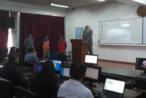 ,
,  ,
,  ,
, 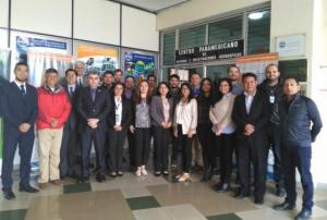
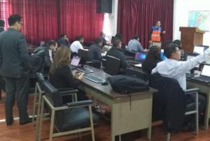
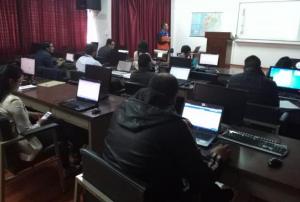
As part of the technical advisory support it provides to countries worldwide in making use of space-based information for disaster management, UN-SPIDER carries out an Institutional Strengthening Mission to Ecuador from 8 to 12 April 2019 upon the request of the Government of Ecuador. This activity is jointly organized by the United Nations Office for Outer Space Affairs (UNOOSA), through its United Nations Platform for Space-based Information for Disaster Management and Emergency Response (UN-SPIDER) and the National Risk and Emergency Management Service of Ecuador. The Military Geographic Institute of Ecuador, the Agustín Codazzi Geographic Institute of Colombia (IGAC) and the Federal University of Santa Maria, Rio Grande do Sul, Brazil, and the Ecuadorian Space Institute support the mission.
During the five-day mission, UN-SPIDER runs a training programme on the "Analysis of satellite…
read moreRegional Support Offices mentioned:08/04/2019
A new review paper presents historical background and current developments for mapping burned area from satellite Earth observation.
The authors explore the physical basis to detect burned area from satellite observations, describes the historical trends of using satellite sensors to monitor burned areas, summarizes the most recent approaches to map burned areas and evaluates the existing burned area products, both at global and regional scales.
Different sensors used for burning radar mapping are also presented, including Radar and Lidar. Finally, it identifies potential future opportunities to further improve burned area detection from Earth observation satellites.
Historically, government agencies collected burned area (BA) information from ground estimates based on field reports from fire management teams.
With the launch of the first Earth observation satellites, remote sensing quickly became a more…
read more04/04/2019
Five years ago, the National Aeronautics and Space Administration (NASA) and the Japan Aerospace Exploration Agency (JAXA) launched the Global Precipitation Measurement (GPM) Core Observatory as a joint satellite. Since then, the instruments on GPM have provided advanced measurements about rain and snow particles within clouds, Earth’s precipitation patterns, extreme weather and precipitation that affects communities around the world.
GPM was engineered to get data to scientists, operational and application users as soon as possible for societal benefits. It obtains data quickly using the Tracking and Data Relay Satellite (TDRS) 12-member satellite constellation, which serves as an information pipeline between Earth-orbiting satellites and NASA ground stations. On average, GPM can take one to three hours to get data into users’ hands, but in emergencies, the average delivery time can be shortened to between 15 and 90 minutes.
GPM’s main…
read more02/04/2019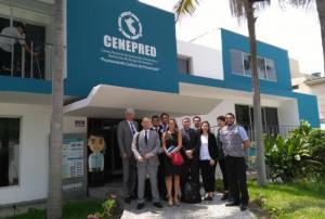 ,
,  ,
, 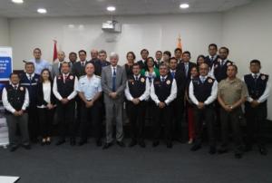
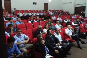
As part of it advisory support activities, UN-SPIDER is carrying out out a Technical Advisory Mission (TAM) to Peru from 1 to 5 April to evaluate the current and potential use of space-based information in all aspects of disaster management. Based on exchanges with a wide range of stakeholders, UN-SPIDER will provide recommendations as to how to strengthen the use of space-based information in disaster risk management and emergency response in the country.
The team of experts led by UN-SPIDER is conducting multiple activities and institutional visits in Lima. The team is comprised of eight experts from UN-SPIDER; the German Aerospace Centre (DLR); the Argentinian National Space Activities Commission (CONAE); the Mexican Space Agency (AEM); the Agustin Codazzi Geographic Institute of Colombia (IGAC); the Santa Maria…
read moreRegional Support Offices mentioned:01/04/2019
Using imagery of the Copernicus Sentinel-2 satellite, researchers from Spain, the United Kingdom and Germany have discovered that more areas in Sub-Saharan Africa are affected by wildfire than previously estimated. In their open-access paper, published in the journal Remote Sensing of Environment, the researchers delineate how they created the first detailed continental map of burnt areas caused by wildfires for 2016.
Specific satellites, such as Sentinel-2, are used to detect disasters like wildfires and map their spreading in order to support relief efforts. Afterwards, the satellites images are used to monitor the traces the fires left behind, especially in remote regions.
Sub-Saharan Africa was picked because…
read more18/02/2019
The Australian Flammability Monitoring System is a new vegetation condition and flammability online mapping tool that is expected to support fire and land managers in Australia.
The mapping tool uses satellite data to collect information on moisture content in highly flammable vegetation such as fallen bark, leaf litter and grass. It then displays this information on an interactive map, which will help fire managers in determining burning efforts and preparing of firefighting resources.
A team of researchers from the Australian National University (ANU) developed the monitoring tool - the first web-based system of its kind in Australia - as part of the Mapping bushfire hazards and impacts research project with the Bushfire and Natural Hazards CRC.
… read more20/09/2018
UN-SPIDER Regional Support Offices with hazard-specific expertise
![]()