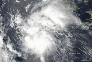
On the 2nd of August 2016 the Visible Infrared Imaging Radiometer Suite (VIIRS) on the Suomi NPP satellite of the National Aeronautics and Space Administration (NASA) captured an image of tropical storm Earl. This tropical storm in the Caribbean Sea already reached Belize, Central America, with winds up to 128km per hour and heavy rainfall. Most of the country was reported lacking electricity and the international airport in Belize City was closed. The government “used radio and television broadcasts to urge residents of low-lying areas to move to higher ground” said the Guardian newspaper.
According to the United States National Hurricane Center, the storm crossed the northern part of Guatemala with winds up to 140 km per hour and…
more

