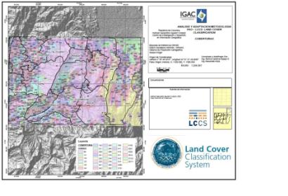
The internal network of the Remote Sensing Group and Geographic Applications of CIAF- IGAC is working on a project for the adaptation of the FAO methodology LCCS “Land Cover Classification System" as an alternative classification system for natural resources management in Colombia. IGAC is UN-SPIDER's Regional Support Office in Colombia; CIAF is IGAC's Center of Research and Development in Geographic Information.
The LCCS is a standard classification system, designed to meet the specific requirements of users, allowing mapping, regardless of the scale or means used. This system was applied to classify land cover nationwide specifically in the area of the jurisdiction of the Regional Autonomous Corporation of Cundinamarca (CAR). Applied at a 1:100,000 scale, the system used a set of independent diagnostic criteria called classifiers, which allowed to correlate with existing classifications and legends like the National legend CORINE (IDEAM-Institute of Hydrology, Meteorology and Environmental Studies, 2010).
To facilitate an alternative and flexible system, the CIAF is evaluating the use of the LCCS as a comprehensive, standardized a priori classification system, to meet specific user requirements, for mapping land cover in the country, independent of the scale or means used to map. The system can be used for any land cover classification initiative anywhere in the world, using a set of independent diagnostic criteria that allow correlation with existing classifications and legends.
Leader Department: Elena Posada (eposada [at] igac.gov.co (eposada[at]igac[dot]gov[dot]co))
Author: Alexander Ariza (alexander.ariza [at] igac.gov.co (alexander[dot]ariza[at]igac[dot]gov[dot]co))

