• English
  • Español
  • Français

United
Nations


Office for Outer Space Affairs
UN-SPIDER Knowledge Portal

  • Home
  • About Us
    • What is UN-SPIDER?
    • About UNOOSA
    • Publications
    • Jobs
    • Meet the Team
    • Contact
  • Space Application
    • Satellite Technology
    • Emergency Mechanisms
    • Recovery Mechanisms
    • International Asteroid Warning Network
    • Space Mission Planning Advisory Group
    • International Space Weather Initiative
    • Space Technologies in the UN
    • User Stories
  • Links & Resources
    • Data Applications
      • Disaster Recovery
    • Data Sources
    • GIS and Remote Sensing Software
    • Online Learning Resources
    • Institutions
  • Risks & Disasters
    • Disaster Risk Management
    • Early Warning Systems
    • Emergency and Disaster Management
    • Natural Hazards
    • Sendai Framework
    • The UN and Disaster Risk Management
    • The UN and Early Warning
    • The UN and Disaster Management
  • Advisory Support
    • Advisory Missions
    • Emergency Support
    • Virtual Advisory Support
    • Recommended Practices
    • Training Activities
    • Practical Uses
  • Network
    • Regional Support Offices
    • GP-STAR
    • MHEWS
    • IWG-SEM
  • Projects
    • SPEAR
    • SEWS-D
    • EvIDENz
    • Flood GUIDE
  • News & Events
    • News
    • Events Calendar
    • UN-SPIDER Events Archive

Breadcrumb

  • Home
  • News and Events
  • View Active News
  • Increasing Parameter Accuracy For Monsoon Forecasting
  • Increasing parameter accuracy for monsoon forecasting

Increasing parameter accuracy for monsoon forecasting

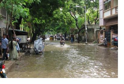
Floods caused by monsoon rains in Indian cities (Image: McKay Savage)Floods caused by monsoon rains in Indian cities (Image: McKay Savage)

The Indian Ministry of Earth Sciences in collaboration with the Department of Space of the National Remote Sensing Centre, and the Center for Ocean and Atmospheric Prediction Studies (Florida State University), has found a more precise parameter for predicting rainfalls during monsoons. It is called Ocean Mean Temperature (OMT) and  is a better indicator than the currently used Sea Surface Temperature (SST). Scientists state that the SST does not represent the heat energy available to the atmosphere on many occasions as it only takes into account the sea-surface skin, while OMT focuses on the whole upper layer of the ocean.

According to Dr. M Rajeevan, researcher at the Ministry of Earth Sciences, "besides improving the understanding of the physics of the challenging problem of predicting monsoons, it is necessary to evaluate the efficiency of the input parameters used in models. The atmosphere interacts with the upper layer of the ocean rather with the sea-surface skin represented by SST alone. Although the atmosphere does respond to SSTs, the evolution of SST patterns depends much on Ocean Heat Content (OHC)".

This new instrument can play a decisive role in crop monitoring for farmers during monsoons, as the slightest variation in rainfall forecasts can have a devastating impact on agricultural activities. Moreover, researchers discovered that rains in India are influenced by the winds in the Arabian Sea which subsequently pass to the Indian Ocean before reaching the country’s coast. 
India Today
Tue, 14 Jul 2015 - 10:40
India

Footer menu

  • Contact
  • Terms of Use

User account menu

  • Log in