Researchers from the University of Melbourne, in collaboration with Tribhuvan University in Nepal and the University of Florence, are helping villagers in Nepal predict and prepare for landslides with a cutting-edge artificial intelligence (AI) system. This initiative, supported by the Government of Nepal and Australia’s Department of Foreign Affairs and Trade, aims to mitigate the devastating impacts of landslides in a region highly susceptible to such disasters.
The new forecasting system, named SAFE-RISCCS, utilizes continuous analysis of satellite images from NASA, the European Space Agency, and the Japan Aerospace Exploration Agency. By integrating these images with an innovative AI tool developed at the University of Melbourne, SAFE-RISCCS can assess rain measurements and ground motion data in real-time to predict landslide risks with greater accuracy. These forecasts will enhance the Landslide Early Warning Systems, offering alerts days or even weeks in advance, thus providing critical lead time for communities at risk.
SAFE-RISCCS will initially be deployed in two high-risk regions in partnership with Nepal’s National Disaster Risk Reduction and Management Authority. This deployment is part of a broader effort to enhance Nepal's Landslide Early Warning System.
The collaborative efforts of international researchers and local authorities, supported by advanced AI technology, aim to significantly enhance landslide prediction and preparedness in Nepal, potentially serving as a model for other regions facing similar natural disaster risks.
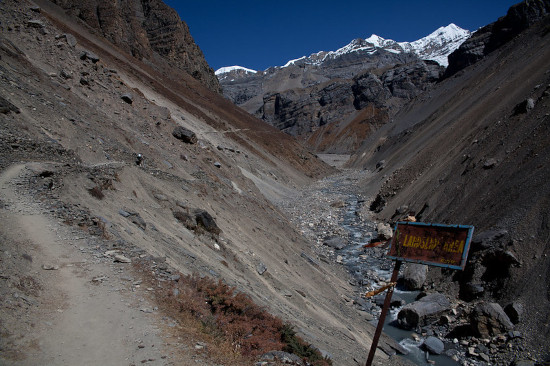
Article Image: Julien Lagarde - Landslide Area, Annapurna Circuit, Nepal. Creative Commons BY-NC-ND 2.0