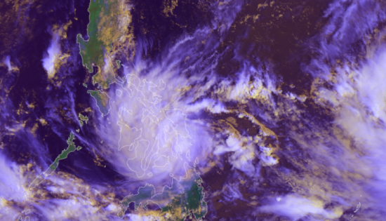
Tropical Storm Megi (also known as Agaton) passed over the Philippines on 10 April, causing landslides and floods in its wake.
The storm struck the east and south coasts of the archipelago, particularly affecting Western Visayas, Eastern Visayas and Craga regions.
35,000 people were evacuated before the storm arrived, and it is estimated that as many as 200,000 have had to leave their homes since then to move to safer locations. Estimates suggest almost a million people may be affected by the disaster.
76 people have been reported killed due to floods and landslides, after rivers burst their banks and debris from hills was washed down, and villages near Baybay City have been badly affected.
UNOOSA/UN-SPIDER requested the activation of the International Charter Space and Major Disasters on behalf of the Philippine Space Agency (PhilSA) and the Philippine National Disaster Risk Reduction and Management Council (NDRRMC)
| Organization | Title | Product type | URL |
|---|---|---|---|
| International Charter Space and Major Disasters | Activation 756: Tropical Storm Megi in the Philippines | Maps | URL |
| UNITAR UNOSAT | Preliminary Satellite-Derived Flood and Landslide Assessment | Maps | URL |
| ReliefWeb | Tropical Storm Megi - Apr 2022 | Situational updates, maps, infographics | URL |
