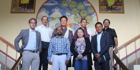
The mission team comprised seven experts: Shirish Ravan (UNOOSA/UN-SPIDER, China), Karma Lodey Rapten (UNDP, Bhutan), Rajan Bajracharya (ICIMOD, Nepal), Lingling Li (NDRCC, China), Stefan Keinberger (University of Salzburg, Austria), Hari Prasad Vajja (ADPC, Bangladesh) and Satya Parkash Katyal (ISRO, India).
Over the course of five days, the mission team conducted several meetings with key government agencies and institutions accompanied by the UN agencies involved. As part of the Technical Advisory Mission, a one-day workshop was conducted on the penultimate day of the mission. The workshop was attended by about 30 officials representing various ministries and departments of the Royal Government of Bhutan as well as numerous institutions. The workshop sought to generate awareness, address issues and suggest areas where space-based information can be utilized to support the disaster management cycle. During the course of the TAM, the mission team held several discussion sessions to reflect upon their findings to compile the assessments and develop a set of recommendations. On the final day, the team concluded with debriefing sessions with Mr. Chhador Wangdi, Director of DDM, MoHCA, and Ms. Christina Carlson, UNRC in Bhutan.
The mission team was made very much aware of the high priority placed on disaster risk reduction by the Bhutan Government. The importance of disaster risk reduction is echoed as one of the 16 National Key Results Area (NKRA) of the Royal Government of Bhutan for the 11th Five-Year Plan (FYP) running from 2013 to 2018.
The Disaster Management Act rightly identified the need of Hazard zone mapping, vulnerability maps and risk assessment. Thus, the mission team noted the DDM’s strive forward to build technical competence to perform tasks like hazard and risk mapping, assessing vulnerability and providing an efficient response during emergencies.
The mission team highlighted that the Department of Disaster Management (DDM) is well positioned to support the disaster risk reduction mandates of Bhutan’s National Disaster Management Authority as the department is currently perceived by stakeholders as the coordination agency. While capacities to use space-based and geospatial information exist in several stakeholder departments, the DDM needs to be strengthened with the appropriate technical capacity and supporting mechanisms to coordinate with stakeholder agencies and develop national programmes.
In addition to several agencies using space technology to prepare map products for disaster risk management, there are various organisations implementing projects with national and international partners using Remote Sensing (RS) and Geographic Information System (GIS) technology which are directly or indirectly contributing to disaster management. The coordination of these activities could be further strengthened to make available a wealth of spatial information.
Policy, Coordination and Cooperation
- Formulation of geo-spatial policy related to disaster risk management, which may evolve finally into a National Spatial Data Infrastructure policy for the country
- The Disaster Management plans and policies should incorporate the use of space-based information and geospatial technology in Disaster Management
- A common approach and strategy is needed to define key concepts and terminologies to enable the reduction of disaster risk with a link to climate change adaptation and the pillars of Gross National Happiness (GHP) should be coordinated by Department of Disaster Management (DDM)
- DDM should further strengthen tools and instruments to coordinate activities, capacities, projects and funds in the context of disaster risk management in Bhutan
Data access, availability and sharing
- DDM should enumerate its data requirements and coordinate with stakeholder agencies for systematic generation data products required for disaster risk reduction decision making
- Remote sensing data coverage for the entire country on medium resolution and specific areas on high resolution is required to enable generation of geospatial layers required for disaster risk reduction
- Satellite data requirements for Bhutan should be streamlined through a single agency to enable judicious utilization of funds. All departments can make use of this data
- DDM should use CGISC as a platform to plan strategies data needs to address current information gaps for disaster risk reduction
Capacity Building and Institutional Strengthening
- A capacity building strategy should be developed to address long-term capacity building needs of DDM and its key stakeholders
- An institution within Bhutan (for example, College of Science and Technology, Royal University of Bhutan) needs to be enabled to offer regular capacity building progammes
- Key agencies in Bhutan should be further linked to regional and international networks (e.g. such as GSDI, GEO etc.)
Strengthening disaster risk reduction decision making
- The DDM has a critical role to play in establishing mechanisms which allow rapid data sharing with hazard and to ensure that risk maps produced by stakeholder agencies are of national standard
- The DDM needs to leverage and expand capacities of stakeholder organisations so that they develop products needed for disaster risk reduction
- Risk and vulnerability mapping should be carried out initially on a pilot basis to develop methodologies and later these methodologies should be applied at the national level. Specific ‘national missions’ should be initiated through DDM to prepare national and sub-national hazard, vulnerability and risk mapping (in a phased manner based on priorities).
- Disaster risk reduction activities and related interventions should be further linked to climate change adaptation and the objectives of Gross National Happiness.
Strengthening early warning and preparedness
- The DDM should embed early warning from Bhutan Department of Hydro-Meteorological Service (DHMS) in the risk management plans. Currently, early warning is a standalone element at DHMS, and therefore its benefits to responders at the field level and communities at risk are not fully exploited.
- The DDM should develop capacities to improve multi-hazard early warning by integrating inputs from DMHS, the Department of Geology & Mines, the National Statistics Bureau and other agencies
- The DDM should play an important role in tailoring/downscaling early warning information to serve decision makers and population at stake (use community-based disaster risk management programme as a base).
- The DDM should integrate early warning information in a Disaster Management Information System (DMIS).
Strengthening emergency response
- DDM should work closely with ICIMOD, which is Data Analysis Node of Sentinel Asia
- DDM should become an Authorised User of the International Charter: Space and Major Disasters
- UN-SPIDER may help DDM to access satellite images through its network in case of disasters when the International Charter and Sentinel Asia is not activated.
- DDM should consider having bilateral arrangements with India (SAARC Framework), Japan, and China to source satellite images during emergencies as well as during normal situations.
- Integration of satellite images with DMIS during emergency response for decision making.
- Information sharing channel and calls for “Standing Orders during emergencies” should be clear.


