At least 20 people have been killed and hundreds of people remain missing after floods struck the Attapeu province of Lao People's Democratic Republic. The collapse of the Xe-Pian Xe-Namnoy hydroelectric dam released 5 billion cubic meters of water downstream, flooding at least 7 villages and washing away homes.
Emergency responders are working to rescue people from the area, evacuate them to emergency shelters and search for the missing. Local authorities have also appealed to government bodies and other communities to provide emergency aid such as clothing, food, drinking water and medicine.
The International Charter was jointly activated by the United Nations Office for Outer Space Affairs (UNOOSA) and the United Nations Institute for Training and Research (UNITAR) Operational Satellite Applications Programme (UNOSAT) for major floods in Lao People's Democratic Republic on 24 July 2018. UNOOSA activated the Charter on behalf of the country's Ministry of Science and Technology and Department of Disaster Management and Climate, while UNITAR-UNOSAT activated the emergency mechanism on behalf of the World Food Programme (WFP). UNITAR- UNOSAT will act as project manager for the activation.
Two UN-SPIDER Regional Support Offices are contributing to this Charter activation: The Asia Disaster Preparedness Center (ADPC) and the International Water Management Institute (IWMI) are acting as so-called Value Added Providers by assessing satellite imagery and developing maps.
Links to emergency mechanism activations can be found below
Links to data, maps and situational information
| DATE | AREA | MAP TYPE | ORGANIZATION |
|---|---|---|---|
| 24 July 2018 | Lao PDR | International Charter Space and Major Disasters | |
| 24 July 2018 | Lao PDR | Flood maps | International Water Management Institute (IWMI) |
| 24 July 2018 | Lao PDR | Lao PDR Flooding Situation Report | UN Office for the Coordination of Humanitarian Affairs (UN OCHA) |
| 25 July 2018 | Lao PDR | Lao Dam Flood Map Comparison | Servir-Mekong
|
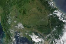
Image: Archive image of seasonal flooding in South-East Asia in 2002. NASA.