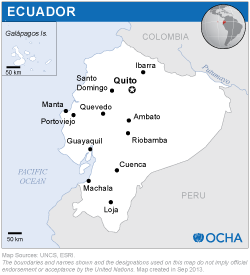
As part of an institutional strengthening mission provided to the Republic of Ecuador upon request of the government, UN-SPIDER carried out a training activity during the same dates, 8-12 April 2019. This activity was jointly organized by the United Nations Office for Outer Space Affairs (UNOOSA), through its United Nations Platform for space-based information for disaster management and emergency response (UN-SPIDER) and the National Risk and Emergency Management Service of Ecuador. The Military Geographic Institute of Ecuador, the Agustín Codazzi Geographic Institute of Colombia (IGAC) and the Federal University of Santa Maria, Rio Grande do Sul, Brazil supported the mission.
The Military Geographic Institute of Ecuador
The Agustín Codazzi Geographic Institute of Colombia (IGAC)
The Federal University of Santa Maria, Rio Grande do Sul, Brazil
UN-SPIDER and the National Risk and Emergency Management Service of Ecuador conducted the training course titled "Analysis of satellite images to monitor floods, droughts and forest fires" to train participants in the fundaments and methods of remote sensing and digital processing of satellite images to obtain useful information for monitoring floods, droughts and forest fires. The course was held at the facilities of the Pan-American Centre for Geographic Studies and Research (CEPEIGE), located at the Military Geographic Institute in Quito, Ecuador, and was attended by 21 participants from various institutions. The course was given by three experts from the Ecuadorian Space Institute, the Agustin Codazzi Geographic Institute of Colombia and the Federal University of Santa Maria in Brazil.
Three types of procedures were presented in this training course:
- Procedures to produce maps showing the geographic extent of floods from radar and optical image processing. This approach was presented by expert Lino Verduga of the Ecuadorian Space Institute;
- Procedure to elaborate a series of maps to show the comparative impact of droughts on vegetation, through the comparative processing of two images for the detection of the severity of forest fires. This approach was presented by expert Carlos Andrés Franco of the Agustín Codazzi Geographic Institute of Colombia;
- Procedure for mapping the geographic extent and severity of forest fires. Through the processing of an extensive set of satellite images from July 2000 to the present, at 16-day intervals, to extract Vegetation Index maps. This approach was presented by the expert Manoel de Araujo Souza Junior from the Federal University of Santa Maria in Brazil.

