On 26 and 27 July 2022, UN-SPIDER, the National Emergency Commission of the Dominican Republic (CNE), and the national office of UNDP organized a virtual training course for staff of the Geospatial Information Team for Disaster Management (EIGEO) of the Dominican Republic. EIGEO was established in 2012 at the recommendation of UN-SPIDER and includes professionals and specialists with GIS and remote sensing skills from more than 15 organizations of the Dominican Republic that contribute to disaster risk reduction, preparedness and response efforts.
More than twenty member of EIGEO participated in the two-day virtual training course which included an introduction to examples of the use of space technologies to map the geographic extent of floods and mudslides, the burn severity of forest fires, and to elaborate flood and storm surge hazard maps.
Juan Carlos Villagran, UN-SPIDER
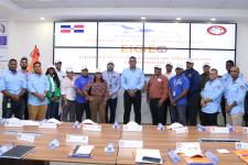
The training course targeted more than twenty of the Technical Interinstitutional Geospatial Team (EIGEO) of the Dominican Republic.
The two-day virtual training course included an introduction to examples of the use of space technologies to map the geographic extent of floods and mudslides, the burn severity of forest fires, and to elaborate flood and storm surge hazard maps. The course also introduced participants to the mechanisms set up by the space community to contribute to disaster response efforts such as the International Charter Space and Major Disasters and Copernicus Emergency Management Service; as well as an introduction to other services set up by Copernicus including the Global Flood Awareness System (GLOFAS), the Global Wildland Fire Information System (GWIS) and the Global Drought Observatory (GDO).
In addition, the virtual training course included content on the UN-SPIDER Recommended Practices that have been developed by UN-SPIDER experts and those of several or its Regional Support Offices to map the extent of floods, debris flow, and to monitor the impacts of drought on vegetation using the Standard Vegetation Index (SVI) and the Vegetation Condition Index (VCI). The training course was also used to raise awareness regarding the use of novel products such as the Copernicus Digital Elevation Model to contribute to landslide and flood hazard assessments.