![]()
United
Nations
Landslide

Definition
Facts and figures
Further information
UN-SPIDER Regional Support Offices with hazard-specific expertise
Related content on the Knowledge Portal
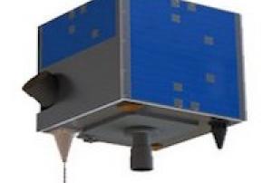
The AlSat-1B satellite was launched into orbit on September 26, 2016 from the Satish Dhawan Space Centre in Sriharikota, India. It was developed by the Algerian Space Agency (ASAL) in corporation with Surrey Satellite Technology Ltd (SSTL). The AlSat-1B satellite orbits at 670 km above the earth's surface and carries a 24m multispectral imager and a 12m panchromatic imager delivering images with a swath width of 140km. The satellite carries two High Speed Data Recorders and two Flash Mass Memory Units capable of recording, managing and storing image data for high speed downlink via S-Band and X-Band transmitters. The data collected by AlSat-1B helps monitor climatological disasters (forest fires, glacial lake outbursts, droughts) and hydrological disasters (landslides and floods).
26/09/2016
Peru’s first Earth Observation satellite was commissioned by the Peruvian government for its national space agency, CONIDA (Comisión Nacional de Investigación y Desarrollo Aeroespacial) in 2014, and constructed in a record time of less than 24 months. PerúSAT-1 features the very-high-resolution optical New AstroSat Optical Modular Instrument (NAOMI) imager designed and developed by Airbus Defence and Space. This silicon carbide optical instrument provides panchromatic images with 70 cm spatial resolution and multispectral images in up to 2 m spatial resolution. PerúSAT-1 is based on Airbus Defence and Space’s AstroBus-S platform, and captures up to 300 images covering an area of 63, 000 km2 per day.
16/09/2016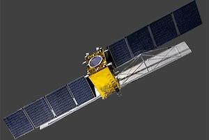
Gaofen-3 was launched into orbit on August 10, 2016 from Taiyuan Satellite Launch Center in China. It was developed by the China Center for Resources Satellite Data and Application (CRESDA). Gaofen-3 orbits at 755 km above the earth's surface and is fitted with a Synthetic Aperture Radar (SAR) sensor that makes use of microwaves in the electromagnetic C-band. The spatial resolution of its imagery ranges between 1 and 500 meters. The data collected by Gaofen-3 helps monitor climatological disasters (droughts) and hydrological disasters (landslides and floods).
10/08/2016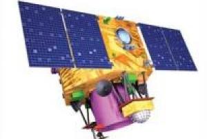
Cartosat-2 is an advanced remote sensing satellite with a single panchromatic camera (PAN) capable of providing scene-specific spot imageries for cartographic applications. The camera is designed to provide imageries with better than one meter spatial resolution and a swath of 10 km. The satellite will have high agility with capability to steer along and across the track up to + 45 degrees. It will be placed in a sun-synchronous polar orbit at an altitude of 630 km. It will have a revisit period of four days. The re-visit can be improved to one day with suitable orbit manoeuvres.
Several new technologies like two mirror on axis single camera, Carbon Fabric Reinforced Plastic based electro optic structure, lightweight, large size mirrors, JPEG like data compression, advanced solid state recorder, high-torque reaction wheels and high performance star sensors are being employed in Cartosat-2.
Beginning with Cartosat 2C, a Multi-spectral camera was added…
read more22/06/2016
KOMPSAT-3A is the world’s first civilian satellite that is equipped with a high-resolution, infrared(MWIR) sensor which enables nighttime observation. It also provides the optical images with high resolution of 50 cm or less for the second in the world following the US.
read more
The technology of improving the optical image quality by 30% or more without degradation using diagonal data to provide 38-cm-class images was developed for the second following the EU.
The high-resolution electro-optical spaceborne camera AEISS-A(Advanced Earth Imaging Sensor System-A) developed by KARI and accommodated on KOMPSAT-3A platform features 50cm class optical photography, which marks the highest resolution among cameras mounted on domestic satellites. The IR sensor, which is capable of detecting heat on the ground, is used to observe fire, volcanic activity and urban thermal islands during nighttime, even under any weather conditions.
KOMPSAT-3A operates in the sun’s…26/03/2015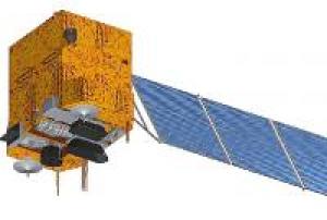
CBERS is a cooperative program between CAST (Chinese Academy of Space Technology) of the People's Republic of China, and INPE (Instituto de Pesquisas Espaciais) of Brazil (government agreement of both countries for the development and operation of two satellites). The program was signed in July 1988 to establish a complete remote sensing system (space and ground segment) to supply both countries with multispectral remotely sensed imagery.
In Nov. 2002, the governments of China and Brazil decided to expand the initial agreement by including another two satellites of the same kind, CBERS-3 and 4, as the second generation of the Sino-Brazilian cooperation effort. The planned cooperative CBERS-3&4 program of CAST and INPE employs enhanced versions of spacecraft and instruments. The specification of the project was agreed upon and closed in July 2004.Instruments:
read more
DCS (Data Collection System)
MUXCAM (Multispectral Camera)
PANMUX (…06/12/2014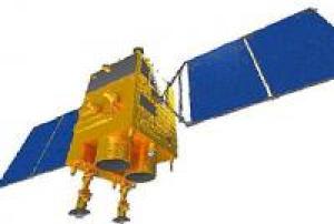
Gaofen-2 is a follow-on mission of the Gaofen-1technology demonstration mission, a series of high-resolution optical Earth observation satellites of CNSA (China National Space Administration), Beijing, China. GF-2 is part of the CHEOS (China High Resolution Earth Observation System) family.
The mission goal of GF-2 to implement sub-meter level, high geographical accuracy Earth surface imaging, promoting application of CHEOS satellites and its social and economic benefits, meanwhile to make breakthrough in key technologies like fast roll and high stable attitude control, long focal length large f-number, lightweight camera design and long life bus design, enhancing China's civilian imaging satellite abilities and reliability.Instrument: PMC-2 (PAN and Multispectral Camera Suite-2)
read more
- 2 barrel-mounted panchromatic cameras
- 2 MS (Multispectral) cameras
- swath width: 23km for each camera / combined swath width: 45.3km19/08/2014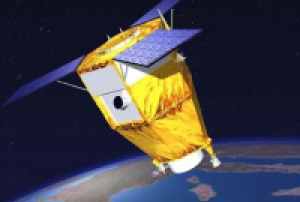
SPOT-7 is a high-resolution wide-swath imaging spacecraft built and operated by Airbus Defence and Space taking over the majority of Spot Image after the government support of the SPOT program was terminated. SPOT-6 – launched in 2012 – and SPOT-7 are identical spacecraft, based on the AstroSat-250 satellite bus and use the NAOMI (New AstroSat Optical Modular Instrument) payload to acquire optical imagery to ensure the continuity of SPOT data, building on experience gained through previous missions, particularly SPOT-5 that launched in 2002.
The SPOT-7 spacecraft is built for a ten-year mission featuring two NAOMI cameras to cover a 60-Kilometer ground swath, 120km using single-pass mosaic imaging. Overall, the satellite can achieve a resolution of two meters in panchromatic and eight meters in multispectral mode covering the visible and near-infrared spectral bands.Instrument: 2x…
read more30/06/2014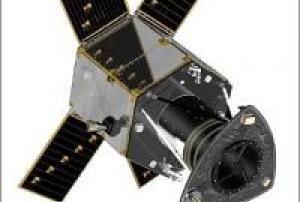
Launched in June 2014 with an expected life-time of more than 7 years, Deimos-2 is an agile, high resolution satellite that became the only European fully-private satellite capable of providing sub-metric multispectral imagery. From a 620-km ascending sun-sync orbit, it has a 12/24-km swath (depending on the imaging mode), stereo-par capability and ±45º off-nadir tilting capacity. Its multispectral camera has a panchromatic and 4 spectral bands (R,G,B,NIR), at 10 bits. This allows Deimos-2 to provide 75-cm pan-sharpened imagery.
Deimos-2 was designed to provide a cost-effective and highly responsive service to cope with the increasing need of fast access to sub-metric imagery. As evidence of this, it provides near-real time image tasking, downloading, processing and delivery to the end user. It has a collection capacity of more than 150,000 km2/day with a two-day average revisit time worldwide. The whole Deimos-…
read more19/06/2014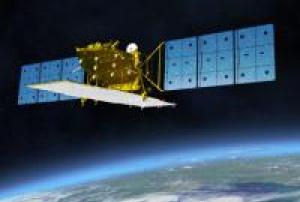
ALOS-2 (Advanced Land Observation Satellite 2) is the follow-on JAXA L-SAR satellite mission of ALOS (Daichi) approved by the Japanese government in late 2008. The overall objective is to provide data continuity to be used for cartography, regional observation, disaster monitoring, and environmental monitoring.
The post-ALOS program of JAXA has the goal to continue the ALOS (nicknamed Daichi) data utilization - consisting of ALOS-2 (SAR satellite) and ALOS-3 (optical satellite) in accordance with Japan's new space program.The state-of-the-art L-band Synthetic Aperture Radar (SAR) aboard ALOS-2, which is an active microwave radar using the 1.2 GHz frequency range, which, in responding to society's needs, has enhanced performance. The SAR is capable of observing day and night, and in all weather conditions.
ALOS-2 has a spotlight mode (1 to 3 m) and a high resolution mode (3 to 10 m). It allows comprehensive…
read more24/05/2014
UN-SPIDER Regional Support Offices with hazard-specific expertise
![]()