Republic of Korea

country taxonomy block

The National Aeronautics and Space Administration (NASA), the European Space Agency (ESA) and the Republic of Korea are working together on a global satellite constellation of three space-based instruments that could track global pollution on an hourly basis. These air quality satellites will measure pollutants, including ozone, nitrogen dioxide, formaldehyde and tiny atmospheric particles called aerosols in order to enhance our understanding of air quality and air pollution. To date, air quality satellites have collected data only once a day. These three new instruments will provide hourly, highly detailed and near-real-time data that will improve air quality science and forecasting around the world, in particular around the most densely populated areas of the Northern Hemisphere. 

Collecting data hourly will...

more
Publishing date 30/03/2020

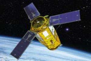
The South Korean Earth observation satellite KOMPSAT-3A has been launched this week from Yasny Launch Base, in Russia.

KOMPSAT-3A is primarily designed to collect optical and infrared imagery for GIS applications associated with environmental, agricultural and oceanographic studies. The satellite will also help responding to natural disasters thanks to its 5.5m resolution IR (Infrared) sensor and 0.55m very high resolution EO (Electro-Optical). The mission is planned for four years and the orbit is a sun-synchronous orbit at an altitude of 528 km.

KOMPSAT-3A has been designed and built by Korea Aerospace Research Institute (KARI), a government-funded research institute located in South Korea, with the technical support of Airbus Defense and Space and German Aerospace Center (DLR). 


Publishing date 30/03/2015

The Korean Aerospace Research Institute KARI has taken over the chairmanship of the International Charter: Space and Major Disasters for a six-months period until April 2015, as the International Charter recently announced on their website. KARI took over from the China National Space Administration (CNSA).

The chairmanship of the International Charter: Space and Major Disasters rotates between member organizations ever six months. Additionally to CNSA, the most recent chairs were the Argentinian space agency, CONAE, and the German Aerospace Center, DLR.

Publishing date 25/12/2014

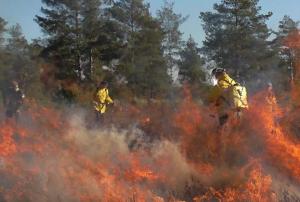
The Korea Forest Service will join forces with Gangwon province to hold the 6th International Wildland Fire Conference (IWFC 2015) in October 2015, in Pyeongchang, Korea, in an effort to exchange views on wildland fire related international issues.

IWFC 2015 will bring together not only policy makers, researchers and practitioners but also international organizations and NGOs from 80 countries to discuss about the global efforts to prevent fire related damages and forge a concerted response to them. Korea has made its utmost effort to undertake greening works and prevent wildland fire damage for the last four decades.

The Conference will provide a platform for the nation to share its know-how for wildland fire prevention and cutting edge technologies including real time wildland fire control system using ICT that has been recently constructed with the international society.

IWFC 2015 is organized jointly with...

more
Publishing date 13/10/2014

The United Nations Asian and Pacific Training Centre for Information and Communication Technology for Development, a regional institute of the United Nations Economic and Social Commission for Asia and the Pacific (UN-APCICT/ESCAP), kicked off the Fourth Regional Training of Trainers Workshop in Seongnam, Republic of Korea. The five-day workshop runs 22-26 February, and will deliver training on the use of information and communication technology (ICT) for disaster risk management and climate change abatement.

As is now widely accepted by the scientific community and the general public, climate change constitutes a major threat to the earth’s ecosystems and combating this threat is important to salvage our future development. There is also general agreement about the impact climate change is having on the frequency and severity of disaster occurrences around the world. To abate climate change and manage disaster risk, there has been much interest and research in the use...

more
Publishing date 23/02/2011

This high profile ministerial conference was organized by the Government of Korea and the International Strategy for Disaster Reduction (ISDR) and took place from 25 to 29 October 2010 in Incheon, Korea. The participants were ministers from Asia and Pacific countries and delegations from governments that included decision makers from the ministries responsible for disaster risk reduction in the respective countries. Technologists, scientists and academic institutions were also represented. The conference aimed at finalizing the Incheon Regional Roadmap on DRR through CCA [Climate Change Adaptation] in Asia and the Pacific (Incheon REMAP) and an action plan for its implementation. The Incheon Declaration on Disaster Risk Reduction in Asia and the Pacific 2010 was the final outcome of the conference. UN-SPIDER and the Asian Disaster Reduction Centre (ADRC) jointly organized the side event “Incorporating space-based information and technology into DRR and CCA” on 26...

more
Publishing date 04/11/2010

The United Nations International Strategy for Disaster Reduction (UNISDR) and the Government of the Republic of Korea are opening Asia's first ISDR Education and Training Institute for Urban Risk Reduction in Incheon, Republic of Korea.

The ISDR Education and Training Institute for Urban Risk Reduction is the first educational and research facility in Asia for disaster risk reduction professionals specialising in urban risk reduction issues. Asia is not only the most populated continent on earth but also the most affected by disasters.

The ISDR Education and Training Institute for Urban Risk Reduction will act as a facilitator for building capacity on urban risk reduction issues including sharing science technologies and data on climate related hazards. The Institute will also train regional government officials and NGO practitioners, thus increasing technical skills and cooperation across the urban development remit.

On the occasion of the Second Session of...

more
Publishing date 12/08/2009

Korea Aerospace Research Institute (KARI)

Contact Person
Mr Yoon Soo Kim
Tel: +82-42-860 2388
Email: younsoo [at] kari.re.kr
Web: http://www.kari.re.kr/

The Korea Forest Service will join forces with Gangwon province to hold the 6th International Wildland Fire Conference in Oct, 2015, in Pyeongchang, Korea, in an effort to exchange views on wildland fire related international issues.

The Conference will bring together not only policy makers, researchers and practitioners but also the international organizations and NGOs from 80 countries to discuss about the global efforts to prevent their damage and forge a concerted response to them. Korea has made its utmost effort to undertake greening works and prevent wildland fire damage for the last four decades.

The Conference will provide a platform for the nation to share its know-how for wildland fire prevention and cutting edge technologies including real time wildland fire control system using ICT that has been recently constructed with the international society.

FOSS4G is the annual global gathering for those both currently or potentially working with open source geospatial software. It brings together a mix of developers, users, decision makers and observers from a broad spectrum of organizations and fields of operation for six days of workshops, presentations, and discussions.

Proposals are invited on any FOSS4G-related subject. However the following list may help to provide some guidance on areas likely to be of interest to attendees: Development: new development in projects; Hacks and Mashes: novel solutions to all our problems; Big Data : geospatial big data; New Trends: IoT, Indoor GIS, etc.; Case Studies: relate your experiences; Benchmarks: comparisons between packages; Business Cases: building the economic case; Policies: FOSS4G related policies around government and international organisations; Visualisation: effective presentation of information; Disaster Response: software, case studies, outcomes; Collaboration: data...

more

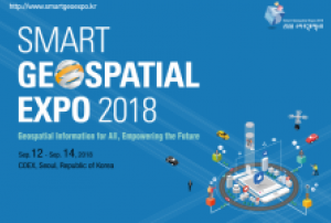
The Smart Geospatial Expo is an annual event with the aim of promoting the development of the geospatial information industry and supporting the overseas expansion of domestic companies. 

The Smart Geospatial Expo has become an annual event since 2008 when many separate events were integrated. Events related to spatial information such as GIS Korea, Cadastral Innovation Expo, and Measurement Day were both integrated and expanded, owing to the reorganization of government departments related to spatial information. The Smart GeospatialExpo includes an exhibition program where host, organizers, and many other geospatial information-related companies and agencies take part in an International Meeting for the Advancement of the Geospatial Information Cooperation for the expansion of exchange and information sharing with foreign guests; and domestic as well as international conferences.