![]()
United
Nations
Glissement de terrain

Definition
Facts and figures
Further information
UN-SPIDER Regional Support Offices with hazard-specific expertise
Related content on the Knowledge Portal

BNSCSat (British National Space Centre Satellite) or UK-DMC 1 is the UK component of DMC. The Disaster Monitoring Constellation (DMC) is an international programme initially proposed in 1996 and led by SSTL (Surrey Satellite Technology Ltd) from the United Kingdom, to construct a network of five affordable Low Earth Orbit (LEO) microsatellites. The objective is to provide a daily global imaging capability at medium resolution (30-40 m), in 3-4 spectral bands, for rapid-response disaster monitoring and mitigation. The Disaster Monitoring Constellation (DMC) is a novel international co-operation in space, led by SSTL bringing together organisations from seven countries: Algeria, China, Nigeria, Thailand, Turkey, the United Kingdom and Vietnam. The DMC Consortium is forming the first-ever microsatellite constellation bringing remarkable Earth observation capabilities both nationally to the individual satellite owners, and internationally to benefit world-wide humanitarian aid…
read more27/09/2003
The satellites SPOT 5 (Satellite Probatoire de l'Observation de la Terre) was a third generation of SPOT earth observation satellite operated by Spot Image.
SPOT 5 used the improved SPOT Mk.3 bus design.
The prime imaging instrument was HRG (High Resolution Geometric), which was built by Astrium SAS of Vélizy, France to continue to improve the HRVIR service of SPOT-4. Two HRG instruments are provided in the conventional SPOT-series double-observation configuration, each with a FOV of 4.13º and the same cross-track pointing capabilities of ±27 º as the HRVIR imager on SPOT-4. The observation coverage of each HRG is 60 km in the nadir direction and >80 km in the oblique configuration.
SPOT-5 carries also the HRS (High Resolution Stereoscopic) instrument, which was developed and built by EADS Astrium SAS, sponsored by CNES and SPOT IMAGE. The objective of this instrument is to provide large-area along-track stereoscopic panchromatic imagery…
read more04/05/2002
The government-owned Landsat 7 was successfully launched on April 15, 1999, from the Western Test Range of Vandenberg Air Force Base, California, on a Delta-II expendable launch vehicle. The Earth observing instrument on Landsat 7, the Enhanced Thematic Mapper Plus (ETM+), replicates the capabilities of the highly successful Thematic Mapper instruments on Landsats 4 and 5.
read more
Landsat 7 is the most accurately calibrated Earth-observing satellite, i.e., its measurements are extremely accurate when compared to the same measurements made on the ground. Landsat 7’s sensor has been called “the most stable, best characterized Earth observation instrument ever placed in orbit.” Landsat 7’s rigorous calibration standards have made it the validation choice for many coarse-resolution sensors.
Considered a calibration-triumph, the Landsat 7 mission went flawlessly until May 2003 when a hardware component failure left…15/04/1999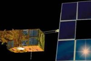
The satellites SPOT 4 (Satellite Probatoire de l'Observation de la Terre) was a second generation of SPOT earth observation satellite operated by Spot Image.
SPOT 4 used the improved bus design, which differed from the earlier SPOT series by having an increased lifetime of five years instead of three, a new extended platform design and service module, which can accommodate twice the payload. The propulsion module consists of a frame made of aluminum bars and two capillary tanks holding 158 kg of hydrazine.
The prime imaging instrument was HRVIR (High-Resolution Visible and Infrared sensor), which consisted of two pushbroom imaging units, an improved version of HRV. The two spectral modes are panchromatic and multispectral. The panchromatic band had a resolution of 10 meters, and the three multispectral bands (G,R,NIR) have resolutions of 20 meters.
An additional sensor for SPOT-4, called Vegetation or VMI (Vegetation Monitoring Instrument), with a ground swath…
read more24/03/1998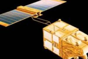
The satellites SPOT 1, 2 and 3 (Satellite Probatoire de l'Observation de la Terre) were the first generation of SPOT earth observation satellites operated by Spot Image.
The first generation SPOT satellites were built on the SPOT Mk.1 bus with a lifetime of three years.
The SPOT satellites were identical, with each carrying two identical HRV (High Resolution Visible) imaging instruments that were able to operate in two modes, either simultaneously or individually. The two spectral modes are panchromatic and multispectral. The panchromatic band had a resolution of 10 meters, and the three multispectral bands (G,R,NIR) have resolutions of 20 meters.
SPOT 3 was orbited on 26 September 1993 on an Ariane-40 H10 rocket. It ended operations in November 1996 due to problems with its stabilization system.
Instruments: 2 HRVs
read more
- 4 spectral bands (1 panchromatic, 3 multispectral)
- imaging swath: 60km x 60km to 80km26/09/1993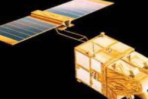
The satellites SPOT 1, 2 and 3 (Satellite Probatoire de l'Observation de la Terre) were the first generation of SPOT earth observation satellites operated by Spot Image.
The first generation SPOT satellites were built on the SPOT Mk.1 bus with a lifetime of three years.
The SPOT satellites were identical, with each carrying two identical HRV (High Resolution Visible) imaging instruments that were able to operate in two modes, either simultaneously or individually. The two spectral modes are panchromatic and multispectral. The panchromatic band had a resolution of 10 meters, and the three multispectral bands (G,R,NIR) have resolutions of 20 meters.
SPOT-2 was launched on 22 January 1990, on an Ariane-40 H10 rocket. It operated until July 2009. Its orbit was lowered to ensure reentry within 25 years.
Instruments: 2 HRVs
read more
- 4 spectral bands (1 panchromatic, 3 multispectral)
- imaging swath: 60km x 60km to 80km22/01/1990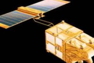
The satellites SPOT 1, 2 and 3 (Satellite Probatoire de l'Observation de la Terre) were the first generation of SPOT earth observation satellites operated by Spot Image.
The first generation SPOT satellites were built on the SPOT Mk.1 bus with a lifetime of three years.
The SPOT satellites were identical, with each carrying two identical HRV (High Resolution Visible) imaging instruments that were able to operate in two modes, either simultaneously or individually. The two spectral modes are panchromatic and multispectral. The panchromatic band had a resolution of 10 meters, and the three multispectral bands (G,R,NIR) have resolutions of 20 meters.
SPOT 1 was launched with the last Ariane-1 rocket on 22 February 1986. At the end of operations in 2003, the orbit was lowered to gradually lose altitude until reentry.
Instruments: 2 HRVs
read more
- 4 spectral bands (1 panchromatic, 3 multispectral)
- imaging swath: 60km x 60km to 80km22/02/1986
Landsat 5 was launched from Vandenberg Air Force Base in California on March 1, 1984, and like Landsat 4, carried the Multispectral Scanner (MSS) and the Thematic Mapper (TM) instruments. Landsat 5 delivered Earth imaging data nearly 29 years - and set a Guinness World Record For 'Longest Operating Earth Observation Satellite', before being decommissioned on June 5, 2013.
read more
The Landsat 5 satellite orbited the the Earth in a sun-synchronous, near-polar orbit, at an altitude of 705 km (438 mi), inclined at 98.2 degrees, and circled the Earth every 99 minutes. The satellite had a 16-day repeat cycle with an equatorial crossing time: 9:45 a.m. +/- 15 minutes. Landsat 5 data were acquired on the Worldwide Reference System-2 (WRS-2) path/row system, with swath overlap (or sidelap) varying from 7 percent at the Equator to a maximum of approximately 85 percent at extreme latitudes.
Landsat 5 long outlived its…01/03/1984
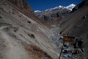
Researchers from the University of Melbourne, in collaboration with Tribhuvan University in Nepal and the University of Florence, are helping villagers in Nepal predict and prepare for landslides with a cutting-edge artificial intelligence (AI) system. This initiative, supported by the Government of Nepal and Australia’s Department of Foreign Affairs and Trade, aims to mitigate the devastating impacts of landslides in a region highly susceptible to such disasters.
The new forecasting system, named SAFE-RISCCS, utilizes continuous analysis of satellite images from NASA, the European Space Agency, and the Japan Aerospace Exploration Agency. By integrating these images with an innovative AI tool developed at the University of Melbourne, SAFE-RISCCS can assess rain measurements and ground motion data in real-time to predict landslide risks with greater accuracy. These forecasts will enhance the Landslide Early Warning Systems, offering alerts days or even weeks in advance, thus…
read more07/06/2024
UN-SPIDER Regional Support Offices with hazard-specific expertise
![]()