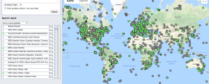
Cette base de données inclut des descriptions d'une grande variété d'images satellitaires, de modèles d'élévation, de cartes d'utilisation et de couverture des sols ainsi que des produits de données en temps quasi réel pour différents types de aléas naturels. Vous pouvez effectuer des recherches dans la base de données par type de données ou d'aléa ainsi que par d'autres facteurs pertinents, notamment les coûts, la couverture temporelle ou spatiale, les types de satellites ou les types de fichiers.
Lorsque vous sélectionnez un pays spécifique sous "couverture spatiale", veuillez noter que le système récupère les ensembles de données qui contiennent exclusivement des informations sur ce pays spécifique (et aucun autre pays). Cela signifie que les ensembles de données mondiales, qui comprennent des informations pour un pays particulier ainsi que pour d'autres pays, ne seront pas affichés. Par conséquent, il est recommandé de commencer par une recherche globale.
Les résultats de chaque recherche sont reliés à d'autres éléments du portail de connaissances ONU-SPIDER, tels que la base de données des logiciels SIG et de télédétection ainsi qu'aux descriptions des aléas naturels.
Pour aider les États membres à identifier et à accéder aux informations spatiales pertinentes, ONU-SPIDER crée également des brochures qui donnent un aperçu des sources de données énumérées sur ces pages et qui présentent un intérêt particulier pour les pays auxquels le programme propose un appui technique consultatif. Les brochures suivantes sont disponibles :
Type: satellite data or aerial image
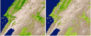
Type: land use, land cover data, satellite data or aerial image
Format: export data, export map, visualization of data (e.g. web GIS or real time monitoring), web processing/cloud computing
Type: land use, land cover data, satellite data or aerial image
Format: export data, export map, visualization of data (e.g. web GIS or real time monitoring), web processing/cloud computing
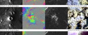
Type: satellite data or aerial image
Type: satellite data or aerial image
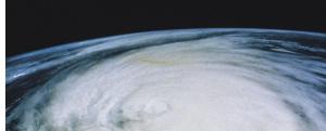
Type: hazard specific data
Type: hazard specific data
Type: hazard specific data
Format: visualization of data (e.g. web GIS or real time monitoring)
Type: hazard specific data
Format: visualization of data (e.g. web GIS or real time monitoring)
Type: hazard specific data
Format: visualization of data (e.g. web GIS or real time monitoring)
Type: hazard specific data
Costs: free with restrictions
Format: statistical data (e.g. graphs)
Type: hazard specific data
Costs: free with restrictions
Format: statistical data (e.g. graphs)
Type: hazard specific data
Format: export data, export map, visualization of data (e.g. web GIS or real time monitoring)
Type: hazard specific data
Hazard: Epidemic,
Insect Infestation,
Drought,
Forest Fire,
Earthquake,
Mass Movement,
Tsunami,
Volcanic Eruption,
Flood,
Extreme Temperature,
Severe Storm,
Pollution Format: export map, statistical data (e.g. graphs)
Type: hazard specific data
Format: export data, export map, web processing/cloud computing
Type: baseline data, land use, land cover data
Type: hazard specific data
Format: export data, export map, statistical data (e.g. graphs), visualization of data (e.g. web GIS or real time monitoring)
Type: hazard specific data


")