![]()
United
Nations
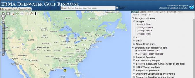
Environmental Response Management Application (ERMA - NOAA)
| Data provided by: | National Oceanic and Atmospheric Administration (NOAA) |
| Data accessibility: | visualization of data (e.g. web GIS or real time monitoring) |
| Link to the data: | |
| File type: | webmap |
| Data type: | hazard specific data |
| Hazard: | Pollution |
| Disaster cycle phase: | Disaster Risk Management, Response, Recovery |
| Space-based Information: | ERMA® is an online mapping tool that integrates both static and real-time data, such as Environmental Sensitivity Index (ESI) maps, ship locations, weather, and ocean currents, in a centralized, easy-to-use format for environmental responders and decision makers |
| Spatial coverage: | Northern America |
| Temporal coverage: | Archive, Near-real time |
| Technical Specifications: | |
| Costs: | free |
| Contact: | ERMA contact |
| Restrictions/ Citation of the dataset: | Citation guidelines: http://gomex.erma.noaa.gov/citation.html
|
Provider
![]()