![]()
United
Nations
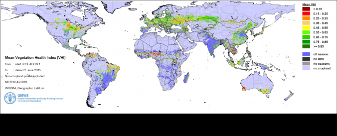
Global Information and Early Warning System (GIEWS - FAO)
| Data provided by: | Food and Agriculture Organization of the United Nations (FAO) |
| Data accessibility: | visualization of data (e.g. web GIS or real time monitoring) |
| Link to the data: | |
| Data type: | hazard specific data |
| Hazard: | Drought |
| Spatial coverage: | Global |
| Spatial resolution: | 1 km |
| Temporal coverage: | Archive, Near-real time |
| Technical Specifications: | |
| Costs: | free |
| Contact: | Contact Details |
| Restrictions/ Citation of the dataset: |
Provider
![]()