![]()
United
Nations
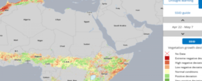
ITHACA Drought Monitoring
| Data provided by: | Information Technology for Humanitarian Assistance, Cooperation and Action (ITHACA) |
| Data accessibility: | visualization of data (e.g. web GIS or real time monitoring) |
| Link to the data: | |
| Data type: | baseline data, hazard specific data, land use, land cover data |
| Disaster cycle phase: | Disaster Risk Management, Response, Recovery |
| Spatial coverage: | Africa |
| Temporal coverage: | Archive, Near-real time |
| Content dates: | 2001- 2016 |
| Costs: | free |
| Contact: | Contact |
| Tutorials on the use of data: | Projects |
| Restrictions/ Citation of the dataset: |
Provider
![]()