![]()
United
Nations
Fire Mapping Tool (FMT)
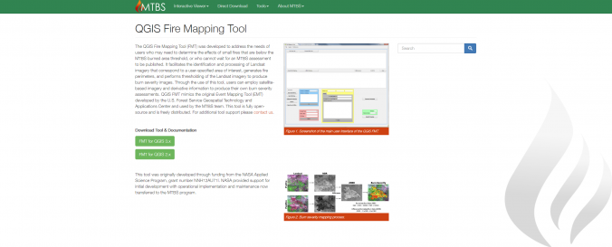
| Description: | The QGIS Fire Mapping Tool (FMT) was developed to address the needs of users who may need to determine the effects of small fires that are below the MTBS burned area threshold, or who cannot wait for an MTBS assessment to be published. It facilitates the identification and processing of Landsat imagery that correspond to a user-specified area of interest, generates fire perimeters, and performs thresholding of the Landsat imagery to produce burn severity images. Through the use of this tool, users can employ satellite-based imagery and derivative information to produce their own burn severity assessments. QGIS FMT mimics the original Event Mapping Tool (EMT) developed by the U.S. Forest Service Geospatial Technology and Applications Center and used by the MTBS team. This tool is fully open-source and is freely distributed. |
| Software type: | Tool/Converter |
| Accessibility: | Install only |
| Requirements: | Requires the installation of QGIS |
| Computer System: | Windows, MacOSX, Linux |
| Scope: | Image processing |
| Vector/Raster: | Raster |
| Optical data or radar data format: | Optical |
| Graphical user interface: | Yes |
| Costs: | Free |
![]()