• English
  • Español
  • Français

United
Nations


Office for Outer Space Affairs
UN-SPIDER Knowledge Portal

  • Home
  • About Us
    • What is UN-SPIDER?
    • About UNOOSA
    • Publications
    • Jobs
    • Meet the Team
    • Contact
  • Space Application
    • Satellite Technology
    • Emergency Mechanisms
    • Recovery Mechanisms
    • International Asteroid Warning Network
    • Space Mission Planning Advisory Group
    • International Space Weather Initiative
    • Space Technologies in the UN
    • User Stories
  • Links & Resources
    • Data Applications
      • Disaster Recovery
    • Data Sources
    • GIS and Remote Sensing Software
    • Online Learning Resources
    • Institutions
  • Risks & Disasters
    • Disaster Risk Management
    • Early Warning Systems
    • Emergency and Disaster Management
    • Natural Hazards
    • Sendai Framework
    • The UN and Disaster Risk Management
    • The UN and Early Warning
    • The UN and Disaster Management
  • Advisory Support
    • Advisory Missions
    • Emergency Support
    • Virtual Advisory Support
    • Recommended Practices
    • Training Activities
    • Practical Uses
  • Network
    • Regional Support Offices
    • GP-STAR
    • MHEWS
    • IWG-SEM
  • Projects
    • SPEAR
    • SEWS-D
    • EvIDENz
    • Flood GUIDE
  • News & Events
    • News
    • Events Calendar
    • UN-SPIDER Events Archive

Breadcrumb

  • Home
  • Links and Resources
  • Online Learning Resources
  • Online Learning Resources

Online Learning Resources


UN-SPIDER acts as a facilitator of capacity-building in the use of space-based information for disaster management and as a gateway to space information for disaster management support. In lines with these roles, the programme curates information about in person as well as online learning opportunities provided by third parties that aim to support users in building skills in using space data and relevant applications to develop information products.

The table below lists online courses that aim at strengthening capacities to acquire, process, and map space-based information to support decision-making. The courses are offered by a wide range of organizations and are displayed below for information purposes.

Please note: The events listed on this page are ongoing (on-demand) online courses. These can usually be attended at any date and time. Registration may be required. For live instructor-led online courses, please visit the Online Training Courses page.

Preview Title Provided by
Introductory Webinar: Earth Observations for Disaster Risk Assessment & Resilience Introductory Webinar: Earth Observations for Disaster Risk Assessment & Resilience

NASA ARSET

Introductory Webinar: Earth Observations for Disaster Risk Assessment & Resilience Introductory Webinar: Earth Observations for Disaster Risk Assessment & Resilience

NASA ARSET

Introductory Webinar: Earth Observations for Disaster Risk Assessment & Resilience Introductory Webinar: Earth Observations for Disaster Risk Assessment & Resilience

NASA ARSET

Introductory Webinar: Earth Observations for Disaster Risk Assessment & Resilience Introductory Webinar: Earth Observations for Disaster Risk Assessment & Resilience

NASA ARSET

Introductory Webinar: Earth Observations for Disaster Risk Assessment & Resilience Introductory Webinar: Earth Observations for Disaster Risk Assessment & Resilience

NASA ARSET

Introductory Webinar: Earth Observations for Disaster Risk Assessment & Resilience Introductory Webinar: Earth Observations for Disaster Risk Assessment & Resilience

NASA ARSET

NASA ARSET Fundamentals Introductory Webinar: Fundamentals of Remote Sensing

NASA ARSET

Grace webinar. Image: NASA Introductory Webinar: Groundwater Monitoring using Observations from NASA’s Gravity Recovery and Climate Experiment (GRACE) Missions

NASA ARSET

Applied Training Introductory Webinar: Introduction to Lightning Observations and Applications

NASA ARSET

Basics of Remote Sensing Land in Focus - Basics of Remote Sensing

EO College

Land in Focus Hazards & Disasters Land in Focus - Hazards & Disasters

EO College

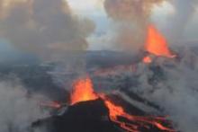
Monitoring Volcanoes and Magma Movements Image Monitoring Volcanoes and Magma Movements

The University of Iceland

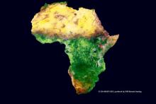
EO Africa Drought MOOC Title MOOC on Drought Assessment and Monitoring from Space

EO Africa R&D

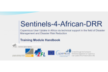
S4ADRR Title Sentinels-4-African-DRR: Training Module Handbook

Center for Remote Sensing of Land Surfaces (ZFL) of the University of Bonn

German Space Agency at DLR

Spatial Data Science and Applications

Yonsei University

Pagination

  • First page « First
  • Previous page ‹ Previous
  • Page 1
  • Page 2
  • Current page 3
  • Page 4
  • Next page Next ›
  • Last page Last »

Footer menu

  • Contact
  • Terms of Use

User account menu

  • Log in