Foreword
This Training Module Handbook is developed in the framework of the project “Copernicus User Uptake in Africa via technical support in the field of Disaster Management and Disaster Risk Reduction” (Short forms: Sentinels-4-African-DRR; S4ADRR). The project is funded through the Framework Partnership Agreement on Copernicus User Uptake (FPCUP Action 2019-2-48) and performed by the German Space Agency at DLR, with the support of the Center for Remote Sensing of Land Surfaces (ZFL) of the University of Bonn, Germany.
The project team collaborates closely with the United Nations Platform for Space-Based Information for Disaster Management and Emergency Response (UN-SPIDER), a program of the United Nations Office for Outer Space Affairs (UNOOSA). Further, there is close collaboration with the teams responsible for the Global Flood Awareness System (GloFAS) and the Global Drought Observatory (GDO) of the Copernicus Emergency Management Service (EMS).
Scope
The S4ADRR project aims for improving the accessibility and usability of Copernicus for different African user groups with a thematic focus on disaster management and disaster risk reduction. This is approached by developing targeted training and information materials based on exchange and feedback-cycles with the user network and additionally supported through the organization of training events, either virtually or linked to relevant events, e.g., events organized by UN-SPIDER.
Introduction
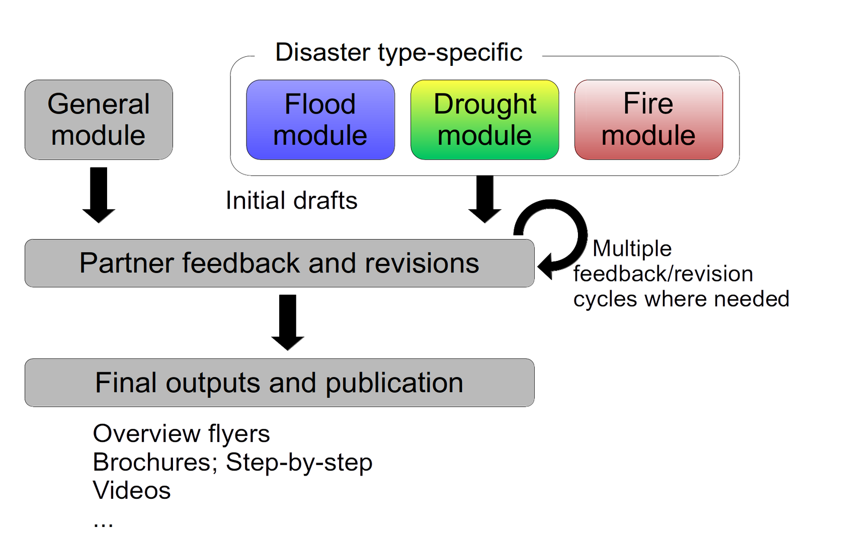
The training materials and guidelines developed in the S4ADRR project are organized in a modular structure. A basic module providing a general overview of the portfolio of the Copernicus program and available to tutorials, overviews and other materials focused on finding, accessing, using, and learning to use services, products, and data on a more general level.
Subsequent modules are focused on thematic fields of application, specifically flood and drought. Here, the focus is on providing more detailed knowledge about available services and data with specific, thematic application examples in mind. Further, advanced methods for analyzing freely available data are addressed in these modules.
In this first version, basic materials are available for all three modules. In future iterations, based on user’s feedback, additional materials like for example video tutorials, use cases, and additional tutorials and guidelines, will be developed and made available. Based on multiple stages and feedback cycles, we aim to better understand user needs and adapt the materials accordingly. The modular approach is visualized in Figure 1.
Access
The handbook and its material can be accessed via the website of the Center for Remote Sensing of Land Surfaces (ZFL).