Airbus Defence and Space has officially launched its Digital Terrain Model (DTM) based on WorldDEM which is now commercially available. This highly accurate standardized representation of bare Earth elevation can be made available for any point on the globe, and with that addition Airbus Defence and Space can provide both surface as well as terrain elevation information. With that WorldDEM also provides the first global, single-source, high-precision Digital Surface Model and has established a new standard of global elevation models.
According to Airbus Defence and Space the unrivalled quality of the original WorldDEM product combined with a sophisticated editing process guarantees highly precise and consistent terrain information. Furthermore it offers an excellent foundation layer for a wide range of applications such as civil engineering (e.g. road design, Earth work calculation), the management of natural resources (e.g. flood modelling), mapping (e.g. derivation of contour lines) as well as military mission planning (e.g. vehicle traffic ability analysis, 3D terrain visualisation).
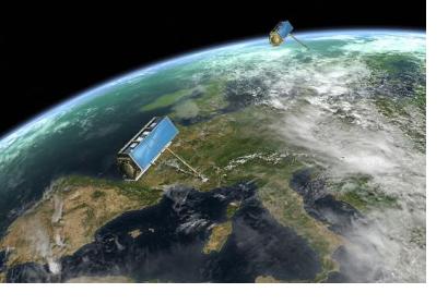
Two high-resolution satellites, TerraSAR-X and TanDEM-X, deliver the data for WorldDEM. To ensure consistent high quality and accuracy of the final product, the satellites covered more complex terrain areas with a third and fourth acquisition campaign. Both satellites started synchronous data acquisition in December 2010 and completed coverage of the Earth’s entire landmass twice over in mid-2013.

