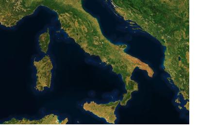
The mapping startup MapBox is a platform that offers users to make custom maps based on open data like OpenStreetMap - free of charge for the standard and paid for premium options. With Cloudless Atlas, on 14 May 2013, they announced the release of "the World's Most Beautiful Map". Until recently, MapBox’s maps were drawings made from OpenStreetMap vector data. In 2012, they released the option to view and use a satellite imagery layer based on free NASA's LANCE-MODIS data from the Terra and Aqua satellites. With the help of imagery specialist Charlie Loyd, they are trying to perfect the satellite view by providing a cloud-free atlas.
The online magazine Wired.com reported:
"How do you go from the chaotic data that a satellite captures to the beautiful idealized images that MapBox is producing now? Pixel by pixel. “For the new release we’re processing two years of imagery, captured from January 1, 2011 through December 31, 2012,” says Loyd, “this amounts to over 339,000 16-megapixel+ satellite images, totaling more than 5,687,476,224,000 pixels. We boil these down to a mere 5 billion or so.”
Once the image data is in MapBox’s hands, the problem is sifting through those images to filter out the clouds, sun glints and atmospheric haze to get a clear image of the ground. Normally, the approach here would be to find each region’s clearest days and quilt them together. “Unfortunately, this leaves seams,” writes Loyd. “Adjacent images may clash (for example, if they’re from different seasons) and draw attention to the base layer in a way that a mapper rarely wants.”
To solve the problem, MapBox takes a much finer-grained approach. It takes all the images it has of an area and stacks them on top of each other. Then, it reorders each column of pixels in the stack based on how cloudy it thinks it is. “We do that for every pixel in the world,” says Loyd."

