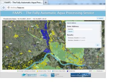
The European Space Agency ESA has helped to create a service that makes flood maps available simply via the Internet. In a disaster flood situation, ground and airborne sensors often reach their limits due bad weather, cloud covers or inaccessible terrain. The availability of satellite data is therefore crucial.
ESA has collaborated with Capgemini, GeoVille Information Systems, Vienna University of Technology and Luxembourg’s Gabriel Lippmann research centre to develop a simple, easy-to-use system that could be available to anyone online, as the agency reported on their website. Near-realtime satellite radar measurements are processed to create location-specific flood maps and deliver them via the Internet. This Fully Automated Aqua Processing Service, or FAAPS, was developed and demonstrated through ESA’s Integrated Application Promotion.
According to ESA’s Olivier Becu, “FAAPS is an excellent example of the added value of satellite data made accessible to crisis management teams for aiding rescue operations."

