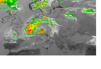
The European Organisation for the Exploitation of Meteorological Satellites (EUMETSAT) and the National Environmental Satellite Data and Information Service (NESDIS) of the National Oceanic and Atmospheric Administration (NOAA) both released lists of their top events, images, videos, and case studies during the year 2021.
Those lists offer spectacular and impressive examples of the use of satellite technologies in various domains in the field of environmental monitoring. Among the case studies listed, we can find examples of the use for disaster risk management, such as monitoring the floods in western Europe in July, the eruption of the Cumbre Vieja volcano on the Canary Island of La Palma in September, or Category-4 Hurricane Ida in August.
Links:
EUMETSAT: Top ten case studies for 2021
NOAA-NESDIS: The top 10 of 2021: A Year from NOAA Satellites

