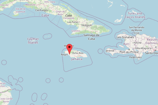
Hurricane Melissa, a Category 5 storm with wind speeds surpassing 150 miles per hour, is rapidly approaching Jamaica and is expected to cause widespread destruction across the island. The storm’s eye is projected to pass west of the country, but its northern side, which carries the strongest winds and rainfall, is forecast to inflict severe damage. Jamaica’s mountainous terrain increases the risk of flash floods, landslides, and significant infrastructure losses. Storm surges of 9 to 13 feet threaten low-lying coastal areas, including Kingston, as heavy rainfall is expected to batter the island for more than 12 hours. The southern coast is likely to be hardest hit, facing surges powerful enough to wipe out infrastructure and severely limit access.
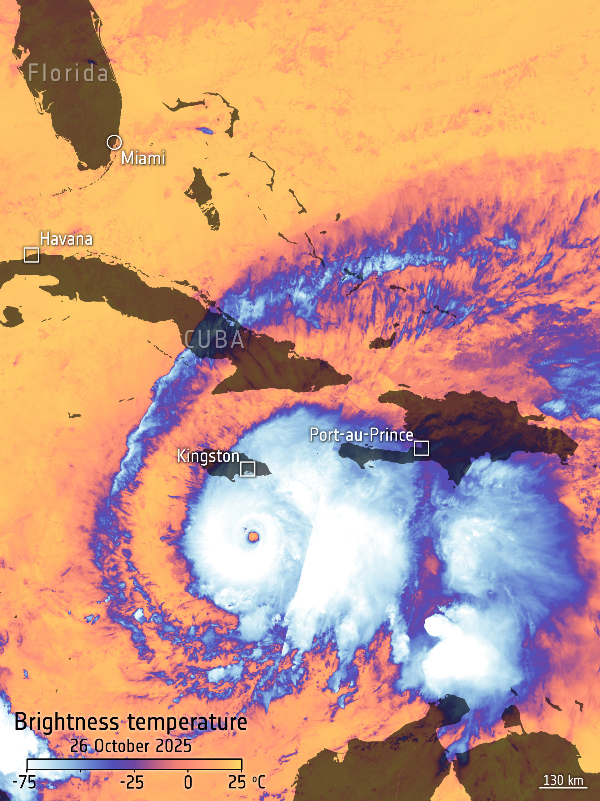
This image, captured by the Copernicus Sentinel-3 mission on 26 October 2025, depicts the brightness temperature at the top of Hurricane Melissa as it swept through the Caribbean Sea toward Jamaica, where it is expected to make landfall.
The cloud tops near the storm’s eye reach extremely low brightness temperatures of around –75°C, while the outer edges register closer to –25°C. In contrast, the surrounding ocean surface remains much warmer, with temperatures of about 25°C. The image has been enhanced with a map overlay showing the landmasses beneath the storm.
Hurricanes of this magnitude can only be effectively monitored through satellite observations, which provide continuous and up-to-date information to help authorities take timely precautionary measures. Both the International Charter ‘Space and Major Disasters’ and the Copernicus Emergency Mapping Service have been activated to support disaster management and recovery efforts in response to Hurricane Melissa.
Satellites deliver vital data on the storm’s structure, extent, wind speed, and trajectory, as well as key atmospheric parameters such as cloud thickness, temperature, and water and ice content. The Sentinel-3 Sea and Land Surface Temperature Radiometer contributes to this monitoring by measuring thermal radiation emitted from Earth’s surface across nine spectral bands.
As of 27 October 2025, Hurricane Melissa—packing sustained winds of around 260 km/h—is moving slowly about 100–130 miles south-southwest of Kingston, Jamaica. The storm poses an extreme threat, with forecasts indicating up to 1 metre of rainfall, storm surges reaching 4 metres along the southern coast, and the potential for severe flooding, landslides, and wind damage.
In preparation, the Government of Jamaica has activated emergency shelters, closed airports and seaports, and issued evacuation orders for coastal and low-lying communities.
Jamaica’s geography makes large-scale disaster response especially difficult. With limited unaffected areas to stage relief operations, external coordination will be critical. Emergency teams are working to secure backup power and communications for local governments to maintain operations during and after the storm. Anticipatory actions are underway to support access to telecommunications and emergency financing, ensuring local authorities and households can respond quickly after impact.
Neighboring countries, including Cuba, Haiti, and the Dominican Republic, are also preparing for the hurricane’s impact. In Cuba, food and essential supplies have been positioned in the eastern region most at risk. The Dominican Republic is reinforcing flood-prone areas and organizing cash support for vulnerable communities. In Haiti, heavy rainfall is expected to cause flooding and road closures, and public safety messages are being shared to help communities prepare.
Regional coordination is underway through Caribbean emergency networks to mobilize sea and air transport and ensure essential items reach countries in need. Humanitarian and government partners across the region are prepared to provide support in logistics, telecommunications, and infrastructure recovery. Hurricane Melissa, the strongest storm to hit the Caribbean since Hurricane Beryl in July 2024, is expected to be the most powerful storm anywhere in the world this year. Its impact will test disaster preparedness and response systems across the region as governments work to protect lives and rebuild critical services.
Sources:
Hurricane Melissa: WFP at hand as Jamaica responds to its ‘worst storm ever’ - Jamaica | ReliefWeb