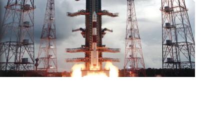
Chennai, April 28 (IANS) India’s latest advanced remote sensing satellite Resourcesat-2 launched last week beamed its first set of pictures Thursday. In a statement, Indian Space Research Organisation (ISRO) said the three cameras of Resourcesat-2 were switched on and high quality images were received by the National Remote Sensing Centre’s Earth Station near Hyderabad in Andhra Pradesh.
On April 20, an Indian rocket Polar Satellite Launch Vehicle (PSLV-C16) precisely launched three satellites – the 1,206 kg Resourcesat-2, the 92 kg Youthsat for stellar and atmospheric studies, and a 106 kg mini satellite X-SAT for imaging applications. Remote sensing satellites send back pictures and other data for use. India has the largest constellation of remote sensing satellites in the world providing imagery in a variety of spatial resolutions, from over a metre ranging up to 500 metres, and is a major player in vending such data in the global market.The data is used for several applications covering agriculture, water resources, urban development, mineral prospecting, environment, forestry, drought and flood forecasting, ocean resources and disaster management.
According to ISRO, Resourcesat-2 has multispectral cameras – Advanced Wide-Field Sensor (AWiFS) with 56 meter spatial resolution; the Linear Imaging Self-Scanning Sensor (LISS-III) with 23.5 meter spatial resolution and LISS-IV Camera with 5.8 meter spatial resolution. As planned by ISRO, the cameras were switched on during the satellite’s 115th orbit. The satellite pass covered a 3,000 km stretch of Indian landmass from Joshimut (in Uttarakhand) to Kannur (in Kerala). According to ISRO, the data from Resourcesat-2 will be made available operationally to the users in few weeks time after due calibration and validation. ISRO had earlier said the precise injection of Resourcesat-2 has saved around 20 kg of onboard fuel enhancing its life span. The satellite at the time of launch was said to have a life span of five years.

