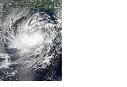
Andhra Pradesh Chief Minister Chandrababu Naidu has directed the Hyderabad National Remote Sensing Centre (NRSC) to use GIS, GPS and remote sensing instruments to detect the detrimental effects caused by Cyclone Hudhud in the region. The NRSC employed geo-tagging to create a map of the damages, in order to facilitate the action of the national disaster response forces (NDRF) deployed to provide support relief.
The cyclone hit India's eastern coast on the weekend, with heavy rains and winds at 170/180 km ph of speed. Although evacuation plans have been implemented after NASA's cyclone alert on 8 October, the storm generated severe consequences, including property and live losses and communication systems' disruption. According to Naidu "the government was able to reduce loss of life due to the precautionary measures taken".
Additionally, India has received relevant satellite-based information through the International Charter: Space and Major Disasters. The international mechanism for satellite-based emergency support was triggered on 12 October 2014 by the Indian Space Research Organisation ISRO. The resulting maps and products will be available for download on the International Charter's website.
The Indian government launched an app for crowdsourcing photos of damages and allocate personnel in the affected areas. Also, a facebook page was created describing the steps necessary to share geo-tagged images through social medias.

