United
Nations
Office for Outer Space Affairs
UN-SPIDER Knowledge Portal
The International Charter: Space and Major Disasters was activated in Indonesia on 13 February by one of UN-SPIDER's Regional Support Offices, the Asian Disaster Reduction Center, in order to provide satellite-based emergency maps for a volcanic eruption in Indonesia. The mechanism was activated on behalf of the Indonesian National Institute of Aeronautics and Space, also one of UN-SPIDER's Regional Support Offices.
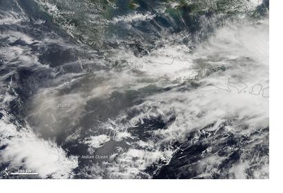
Mount Kelud erupted late on 13 February. 100,000 people were evacuated and around 200,000 were affected. The volcano is located on the island Java and the eruption spread debris and ash as far as 200 km.
The cities closest to the volcano are nearly entirely covered with ash, causing breathing troubles for its inhabitants. The volcano last erupted in 1990, when it killed 30 people. This latest eruption caused two casualities. Authorities believe that the eruption has stopped, but the ash and debris keep causing health, economic and infrastructural problems in the region.
That is the second volcano eruption in Indonesia this year. As UN-SPIDER reported, Mount Sinabung, located on the neighboring island of Sumatra erupted last month.
