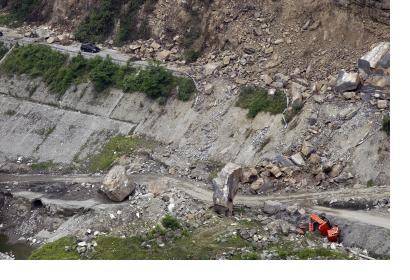
On Saturday, 20 April 2013, a 7.0 magnitude earthquake struck Lushan County of Sichuan province, South-West China, at 08:02am (UTC). Multiple aftershocks were felt in the area increasing fears of landslides.
On the same day, the International Charter "Space and Major Disasters" was activated to provide up to date satellite imagery and maps for the area affected by the earthquake. Some of the areas are extremely remote and relief supplies are reaching these areas slowly. Satellite images can give a clearer picture of the extent of destruction in these remote areas as well as of the state of roads. The activation of the mechanism was requested by the National Disaster Reduction Center of China / China Meteorological Administration.
Media reports suggest that more than 200 people are dead or missing, 11,500 are injured of which 960 are serious and thousands more are left homeless after the quake. The extent of the damage is still unknown however; several homes have been destroyed, villages have been ruined and communication networks are disrupted.
The images and maps will be made available on the International Charter's website.

