• English
  • Español
  • Français

United
Nations


Office for Outer Space Affairs
UN-SPIDER Knowledge Portal

  • Home
  • About Us
    • What is UN-SPIDER?
    • About UNOOSA
    • Publications
    • Jobs
    • Meet the Team
    • Contact
  • Space Application
    • Satellite Technology
    • Emergency Mechanisms
    • Recovery Mechanisms
    • International Asteroid Warning Network
    • Space Mission Planning Advisory Group
    • International Space Weather Initiative
    • Space Technologies in the UN
    • User Stories
  • Links & Resources
    • Data Applications
      • Disaster Recovery
    • Data Sources
    • GIS and Remote Sensing Software
    • Online Learning Resources
    • Institutions
  • Risks & Disasters
    • Disaster Risk Management
    • Early Warning Systems
    • Emergency and Disaster Management
    • Natural Hazards
    • Sendai Framework
    • The UN and Disaster Risk Management
    • The UN and Early Warning
    • The UN and Disaster Management
  • Advisory Support
    • Advisory Missions
    • Emergency Support
    • Virtual Advisory Support
    • Recommended Practices
    • Training Activities
    • Practical Uses
  • Network
    • Regional Support Offices
    • GP-STAR
    • MHEWS
    • IWG-SEM
  • Projects
    • SPEAR
    • SEWS-D
    • EvIDENz
    • Flood GUIDE
  • News & Events
    • News
    • Events Calendar
    • UN-SPIDER Events Archive

Breadcrumb

  • Home
  • News and Events
  • View Active News
  • ISRO To Support Indian State of Uttarakhand With Satellite-based Forecasting and Monitoring
  • ISRO to support Indian state of Uttarakhand with satellite-based forecasting and monitoring

ISRO to support Indian state of Uttarakhand with satellite-based forecasting and monitoring

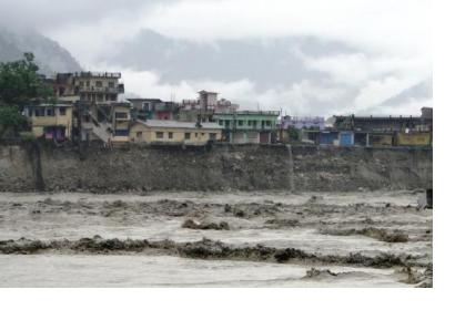
Floods in Uttarakhand, India, in 2013.Floods in Uttarakhand, India, in 2013. Photo: Oxfam International/BY-NC-ND 2.0

The Indian state of Uttarakhand has signed a memorandum of understanding (MoU) with the Indian Space Research Organisation (ISRO) in Ahmedabad on 15 February. This understanding gives the Uttarakhand Disaster Mitigation & Management Centre (DMMC) access to the satellite imagery data produced by ISRO to put to use in forecasting potential issues for better disaster management and monitoring weather conditions.

Under the partnership with ISRO, Uttarakhand will be alerted about detectable disasters at least 72 hours in advance, allowing more time for appropriate response procedures to be put in place than is currently the case, and giving a fuller, more detailed image of the entire state for potential issues.

This partnership will also allow post-disaster imagery to become instantly available for analysis by DMMC, which can be useful in assessing damages and developing future strategies in mitigation. Previously, the state had only been able to access this data by making a request with the central government’s database.

Created in 1969, ISRO is the official space agency of the Government of India. Their applications deal primarily with Earth observation, navigation, communication, climate and environment, and disaster management.
Uttarakhand inks MoU with ISRO for advanced satellite-based forecast
Thu, 22 Feb 2018 - 16:13
India

Footer menu

  • Contact
  • Terms of Use

User account menu

  • Log in