United
Nations
Office for Outer Space Affairs
UN-SPIDER Knowledge Portal
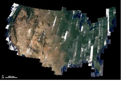
A year ago NASA’s Landsat-8 satellite was launched into orbit. During this year scientists have been analyzing the data delivered by the satellite. They have calibrated the information against ground observations and information gathered from other Landsat missions.
The data files from the new satellite are larger than from the former Landsat missions. The researchers’ team will pre-process the data and create a Web-Enabled Landsat Data (WELD) which will allow scientists to preview data before downloading.
Since Landsat-8 is the first Landsat satellite with GPS on board, which makes it easier to appoint the exact location of every single image. This improves mapping and allows to compare images to other missions. But one of the most important feature of this satellite mission is that - as in previous Landsat missions - its information is made accessible to the public.
