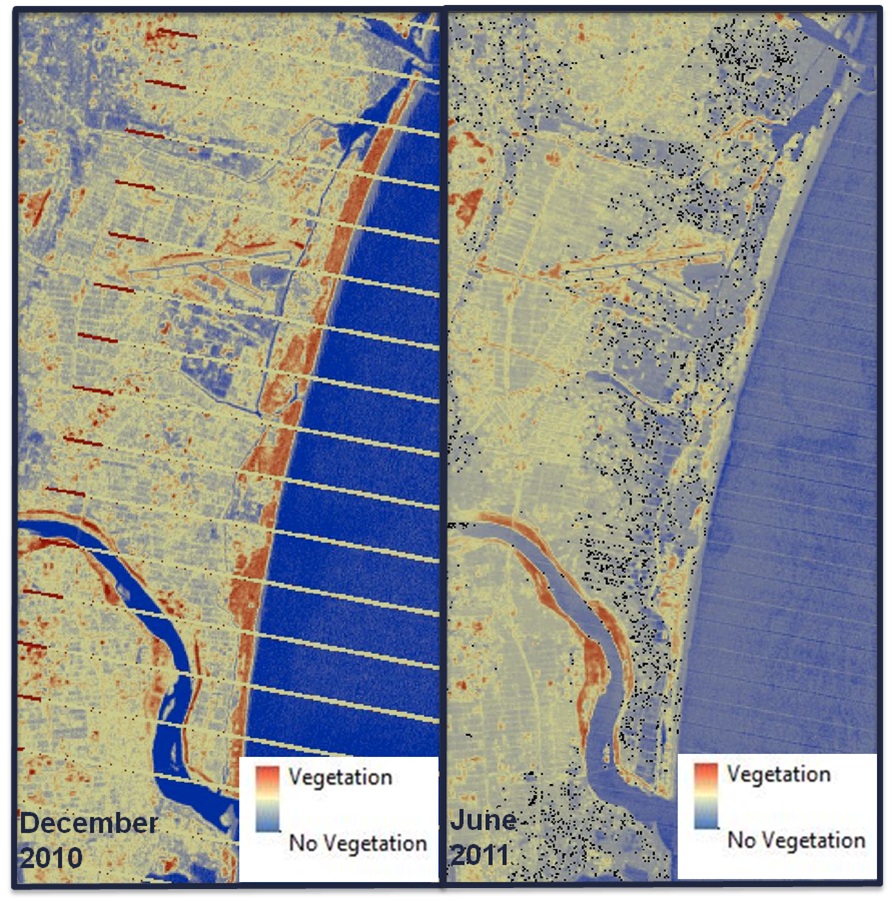
On March 11, 2011, the Great Tohoku Earthquake occurred approximately 70 kilometers off the coast of Japan. This magnitude 9.0 earthquake was closely followed by a massive tsunami that reached 7 meters in height. Using NASA Earth Observation Systems (EOS), we will assess the damage to the area impacted by this disaster. Landsat 5 Thematic Mapper (TM), MODIS on Aqua and Terra, and ASTER will be used to create normalized difference vegetation indices (NDVIs) and land classifications of the area. MODIS also will be used to measure sea surface temperature to assess the feasibility of using this data for detecting radioactive water released from nuclear power plants affected by the earthquake and tsunami. An analysis of the economic impact of this disaster also will be made to help policy makers in the U.S. and Japan. This research will show the benefit of using NASA EOS to provide support for disasters around the world.
For more information, please follow the link below to the original article.