We recently published a new Data Application of the Month on the topic of Disaster Recovery.
The recovery in the aftermath of a disaster involves the processes of rebuilding and restoring infrastructure and livelihoods, as well as economic, physical, social, cultural and environmental assets, systems and activities following the immediate response after a disaster. In order to reduce the risk of future disasters, the recovery process needs to be used as an opportunity to rebuild the affected areas and communities in a way that ensures a resilient and sustainable future.
Space technologies and remote sensing data and techniques are used in all phases of the Disaster Management Cycle, ranging from vulnerability analysis and risk modelling to early warning and the facilitation of relief and response operations. However, different phases of the disaster management cycle require different approaches on using space technologies. Using satellite imagery during the response phase for example, follows different priorities and indicators and requires a fast data provision. Meanwhile during recovery efforts, the time pressure is reduced and the main focus shifts to a more in-depth analysis.
Earth Observation (EO) satellites can support the recovery efforts in many ways such as by monitoring and collecting information regarding reconstruction efforts, damage assessment, population displacement or understanding the effects of different recovery scenarios and thus providing tools for decision-makers and much more. A selection of potential use cases to support recovery efforts can be explored on the new Data Application of the Month page on the topic of Disaster Recovery.
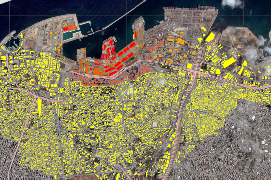
Main Title Image: Copernicus Emergency Management Service (© 2020 European Union), [EMSN081] Beirut, Lebanon: Detailed damage assessment analyses. Detail 01. Retrieved from https://emergency.copernicus.eu/mapping/ems-product-component/EMSN081_01BEIRUT_P13DDA_00OVERVIEW/1