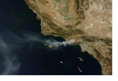
A new system of wildfire detection based on satellite data has recently been developed by the University of Berkeley in conjunction with Lawrence Berkeley National Laboratory, called Fire Urgency Estimation from Geosynchronous Orbit (FUEGO). It employs a satellite mounted with megapixel infrared cameras that monitors a patch of land in California. Then it sends the data to a geospatial information system on the ground that stores a large database of land use, rainfall, flammability and other factors related to fire emergency.
Astronomical satellites are exceedingly sensitive and could sense the outbreak of wildfires very early in their growth, when they are easier to contain and manage. Calculations show that with a reasonable half-meter aperture telescope and a contemporary multi-megapixel staring array sensor (as contrasted with the traditional scanning diode sensor), an extraordinary signal to noise ratio can be achieved, which is essential to quickly and reliably detect small scale wildfires with high confidence and low false alarm rates.
Additionally, the researchers also consider employing drones to take images close to the ground in high-quality and at night, when aerial tankers are not operating. However, they will not be employed until the Federal Aviation Administration (FAA) clarifies if unmanned aircrafts can be used during emergency situations.

