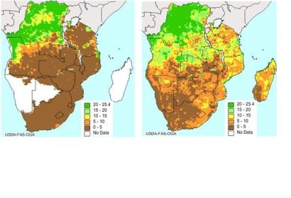
The European Space Agency’s Soil Moisture and Ocean Salinity (SMOS) mission was orginally designed to deliver information on water cycles. The satellite is now also being used to predict droughts and to monitor crop yield.
The US Department of Agriculture regularly uses radar satellite images with soil moisture information to make predictions of crop yield. They now started incorporating SMOS satellite information into their forecasting. ESA explains: "Carrying a novel sensor, SMOS captures images of ‘brightness temperature’. These images correspond to microwave radiation emitted from Earth’s surface and can be related to soil moisture and ocean salinity – two key variables in Earth’s water cycle." With this data on soil moisture, the experts can predict how the health of plants will change and, therefore, how productive they will be.
The application is especially important for regions that may need food aid as a result of severe drought. “The positive impact of SMOS is especially significant over data-poor areas of the world prone to food insecurity and famine such as southern Africa”, said Matthias Drusch, ESA’s SMOS mission scientist.

