  • English
  • Español
  • Français

United
Nations


Office for Outer Space Affairs
UN-SPIDER Knowledge Portal

  • Home
  • About Us
    • What is UN-SPIDER?
    • About UNOOSA
    • Publications
    • Jobs
    • Meet the Team
    • Contact
  • Space Application
    • Satellite Technology
    • Emergency Mechanisms
    • Recovery Mechanisms
    • International Asteroid Warning Network
    • Space Mission Planning Advisory Group
    • International Space Weather Initiative
    • Space Technologies in the UN
    • User Stories
  • Links & Resources
    • Data Applications
      • Disaster Recovery
    • Data Sources
    • GIS and Remote Sensing Software
    • Online Learning Resources
    • Institutions
  • Risks & Disasters
    • Disaster Risk Management
    • Early Warning Systems
    • Emergency and Disaster Management
    • Natural Hazards
    • Sendai Framework
    • The UN and Disaster Risk Management
    • The UN and Early Warning
    • The UN and Disaster Management
  • Advisory Support
    • Advisory Missions
    • Emergency Support
    • Virtual Advisory Support
    • Recommended Practices
    • Training Activities
    • Practical Uses
  • Network
    • Regional Support Offices
    • GP-STAR
    • MHEWS
    • IWG-SEM
  • Projects
    • SPEAR
    • SEWS-D
    • EvIDENz
    • Flood GUIDE
  • News & Events
    • News
    • Events Calendar
    • UN-SPIDER Events Archive

Breadcrumb

  • Home
  • News and Events
  • View Active News
  • Regional Support Offices: IGAC Conducts Desertification Analyses
  • Regional Support Offices: IGAC conducts desertification analyses

Regional Support Offices: IGAC conducts desertification analyses

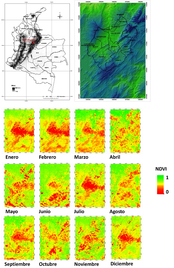
The Colombian Agustin Codazzi Geographic Institute - IGAC and their Center of Research and Development of Geographic Information – CIAF, recently did a series of projects based on risk management. One of those was focused on indentifying zones in the process of decertification using optical remote sensing in the Andean dry region of Villa de Leyva (Boyacá), Colombia. For this, the experts analyzed the values of the NDVI (Normalized Difference Vegetation Index) from 60 rasters per month (from January 2006 to December 2010) obtained from a MODIS sensor (Moderate Resolution Imaging Spectroradiometer). Based on the results of this analysis, zones in process of desertification were identified through linear and nonlinear regressions between the years 2000 and 2010 based on the values of the index in a certain season of the year. Finally, the IGAC experts estimated change between 2000 and 2010 for three categories that are usually employed to calculate the spatial change in desertification: desertified areas, areas with high risk of desertification and areas with low risk of desertification.


More information on this will be available in the next issue of the IGAC Magazine Geographic Analysis.

Thu, 26 Jul 2012 - 16:02
Colombia
Colombia Regional Support Office

Footer menu

  • Contact
  • Terms of Use

User account menu

  • Log in