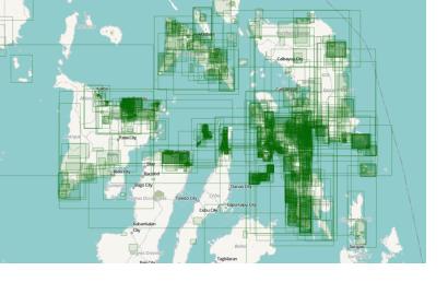
More than 900 volunteers are helping in the recovery efforts in Philippines by collaborating on online maps, through the OpenStreetMap network. The method uses satellite technology and the knowledge of the public to develop those maps in order to help relief organizations. One week after Typhoon Haiyan hammered the islands, blocked roads, destroyed buildings and downed telecommunications systems it still difficult for survivors to receive the water and food they so desperately need. Relief workers continue struggling to reach some of the most devastated regions of the Philippines.
To help relief actions, the OpenStreetMap network maps the roads and buildings that were there before the typhoon struck. “Roads and buildings are the most important things for us,” Dale Kunce, a geospatial engineer with the American Red Cross says. “We need to map the roads so that we know where to go, so that we know how to get around, basically. We wanted to map all of the buildings so that we could map what was there before, so that we could start to do damage assessments to understand the overall calamity of what happened, so that we could then prioritize different areas.”
Several providers and organisations have captured the storm and its effects using space-based information. UN-SPIDER has compiled the links in a Google docs spreadsheet that can be found here.

