• English
  • Español
  • Français

United
Nations


Office for Outer Space Affairs
UN-SPIDER Knowledge Portal

  • Home
  • About Us
    • What is UN-SPIDER?
    • About UNOOSA
    • Publications
    • Jobs
    • Meet the Team
    • Contact
  • Space Application
    • Satellite Technology
    • Emergency Mechanisms
    • Recovery Mechanisms
    • International Asteroid Warning Network
    • Space Mission Planning Advisory Group
    • International Space Weather Initiative
    • Space Technologies in the UN
    • User Stories
  • Links & Resources
    • Data Applications
      • Disaster Recovery
    • Data Sources
    • GIS and Remote Sensing Software
    • Online Learning Resources
    • Institutions
  • Risks & Disasters
    • Disaster Risk Management
    • Early Warning Systems
    • Emergency and Disaster Management
    • Natural Hazards
    • Sendai Framework
    • The UN and Disaster Risk Management
    • The UN and Early Warning
    • The UN and Disaster Management
  • Advisory Support
    • Advisory Missions
    • Emergency Support
    • Virtual Advisory Support
    • Recommended Practices
    • Training Activities
    • Practical Uses
  • Network
    • Regional Support Offices
    • GP-STAR
    • MHEWS
    • IWG-SEM
  • Projects
    • SPEAR
    • SEWS-D
    • EvIDENz
    • Flood GUIDE
  • News & Events
    • News
    • Events Calendar
    • UN-SPIDER Events Archive

Breadcrumb

  • Home
  • News and Events
  • View Active News
  • Review Article Discusses Using Remote Sensing-based Proxies To Improve Urban Disaster Risk Management and Resilience
  • Review article discusses using remote sensing-based proxies to improve urban disaster risk management and resilience

Review article discusses using remote sensing-based proxies to improve urban disaster risk management and resilience

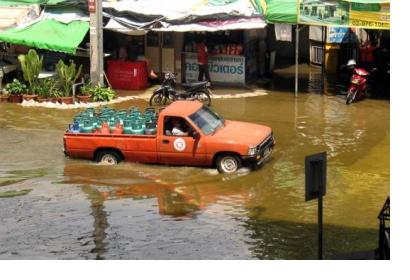
Flooding in the Pak Kret area of Bangkok, Thailand in 2011. Image: Philip Roeland/Flickr.Flooding in the Pak Kret area of Bangkok, Thailand in 2011. Image: Philip Roeland/Flickr.

Remote sensing, or obtaining information about the Earth’s surface from afar using satellites or high altitude aircraft, is an important tool for predicting, mitigating, and managing disasters. To obtain a more comprehensive view of the conditions on Earth, remote sensing analysts must often look beyond information that can be immediately extracted from satellite imagery, for example, and use proxies, or indirect measurements based on this information, in order to evaluate other factors.

A recent study, Remote Sensing-Based Proxies for Urban Disaster Risk Management and Resilience: A Review, identifies and evaluates some of these remote sensing proxies used to evaluate both pre- and post- disaster elements, taking into consideration the “built-up” environment, including buildings and transport networks, the economic environment, the social environment, and the natural environment. The authors identified these proxies through a review of 114 key publications on the topic.

In the publications highlighted by the authors, several examples of remote sensing proxies were presented. As an example of a proxy to evaluate the social environment in the post-disaster phase, the authors highlighted that in one publication, “the number of urban facilities, such as hospitals and schools … [served] as a proxy to assess the social resilience of a community to disaster. An increase in the number of facilities indicates an increase in social resilience.”

The study focuses specifically on the use of these proxies to understand urban environments, given the increasing rate of urbanisation, with the United Nations estimating that 68 percent of the world’s population will live in urban areas by 2050.

The authors maintain that increased evaluation of remote sensing proxies across a number of different fields impacted by disaster, is critical for improving disaster risk management methods.

The full study can be accessed here.
 
Remote Sensing-Based Proxies for Urban Disaster Risk Management and Resilience:…
Fri, 31 May 2019 - 15:57
Global

Footer menu

  • Contact
  • Terms of Use

User account menu

  • Log in