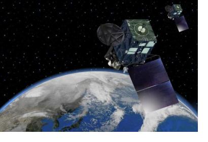
A group of scientists from the Riken Advanced Institute for Computational Science has undertaken a new project that aims to improve weather forecasting. The project makes use of data from the Japanese Himawari-8 satellite and combines it with a supercomputer programme at the Riken science institute. The project aims to significantly improve weather predictions, particularly in the case of extreme weather, in order to improve official warnings and to ultimately help save lives.
In order to predict future weather, weather prediction models run simulations that are based on current conditions coming from various data sources. Accurate predictions are rather difficult to conduct due to the inherently complex nature of weather systems and the lack of precision and timeliness of the data.
As a solution to this problem, scientists have tried to run simulations that use more frequently updated and accurate data. The new Riken project uses, for the first time, infrared luminance data. This type of data has a great advantage in that it is not hindered by heavy cloud clover and can therefore offer a more reliable model of weather patterns.
Himawari-8 is a geostationary satellite that can scan the entire area it covers every ten minutes. The data is scanned in both visible and infrared light, at a resolution of up to 500 meters, and it can subsequently be provided to meteorological agencies for analysis. The infrared measurements can help scientists observe where clouds are located and at what altitude in order to be able to evaluate rainfall more efficiently. The incorporation of satellite data at frequent intervals into weather prediction models can improve rainfall predictions and allow scientists to predict more precisely the rapid development of a typhoon for example. Ground-based and airborne weather monitors, which are traditionally used by forecasters, are not fully reliable during extreme weather events such as hurricanes and typhoons. The Riken system has an advantage over the traditional tools since it would continue to function during such events and to provide data captured from space.
Thanks to more accurate and up-to-date pictures of potentially dangerous weather phenomena, local officials can issue evacuation warnings faster and thus allow more time for evacuation to those people who are more vulnerable to natural disasters such as the elderly or people with disabilities.

