The Swiss Seismological Service (SED) at ETH Zürich introduced on March 7 the first seismic risk model for Switzerland. The new model, that complements the Seismic Hazard Map published by SED in 2004, shows the potential impact of earthquakes on the population and infrastructure in the country. The seismic risk model, that combines information about earthquake risk, effects of the local substrate, building vulnerability, and affected persons and assets, is freely available to the public. The model is intended to help government agencies make informed decisions in the face of disaster preparedness and disaster management.
Based on the seismic risk model, it is estimated that destructive earthquakes in the country over the next 100 years could cause population loss from 150 to 1,600 people, with approximately 40,000 to 175,000 people rend homeless, and causing economic damages of CHF 11 to 44 billion to infrastructure and their contents alone. The model does not yet account for further damage and loss from landslides, fires, or operational disruption casued by earthquakes.
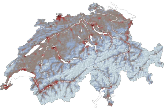
Photo: Earthquake risk map of Switzerland. Dark red zones: very high risk, light blue areas: very low risk. © Schweizerischer Erdbebendienst SED