• English
  • Español
  • Français

United
Nations


Office for Outer Space Affairs
UN-SPIDER Knowledge Portal

  • Home
  • About Us
    • What is UN-SPIDER?
    • About UNOOSA
    • Publications
    • Jobs
    • Meet the Team
    • Contact
  • Space Application
    • Satellite Technology
    • Emergency Mechanisms
    • Recovery Mechanisms
    • International Asteroid Warning Network
    • Space Mission Planning Advisory Group
    • International Space Weather Initiative
    • Space Technologies in the UN
    • User Stories
  • Links & Resources
    • Data Applications
      • Disaster Recovery
    • Data Sources
    • GIS and Remote Sensing Software
    • Online Learning Resources
    • Institutions
  • Risks & Disasters
    • Disaster Risk Management
    • Early Warning Systems
    • Emergency and Disaster Management
    • Natural Hazards
    • Sendai Framework
    • The UN and Disaster Risk Management
    • The UN and Early Warning
    • The UN and Disaster Management
  • Advisory Support
    • Advisory Missions
    • Emergency Support
    • Virtual Advisory Support
    • Recommended Practices
    • Training Activities
    • Practical Uses
  • Network
    • Regional Support Offices
    • GP-STAR
    • MHEWS
    • IWG-SEM
  • Projects
    • SPEAR
    • SEWS-D
    • EvIDENz
    • Flood GUIDE
  • News & Events
    • News
    • Events Calendar
    • UN-SPIDER Events Archive
  • Admin
    • SAM Items

Breadcrumb

  • Home
  • News and Events
  • View Active News
  • TerraSAR-X Satellite Will Continue Providing Data For Copernicus Data Warehouse
  • TerraSAR-X satellite will continue providing data for Copernicus Data Warehouse

TerraSAR-X satellite will continue providing data for Copernicus Data Warehouse

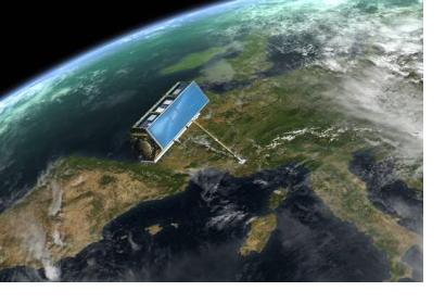
TerraSAR-X satellite monitoring Europe (Image: ESA)TerraSAR-X satellite monitoring Europe (Image: ESA)

Airbus Defence and Space and ESA have signed an agreement that enables Copernicus Data Warehouse to continue receiving TerraSAR-X satellite information until the end of 2020. This space artifact offers data used for addressing emergency and security related issues, reliable monitoring needs, and land cover change with high reliability and accuracy to European public institutions.

TerraSAR-X, launched in 2007, is an Earth observation satellite developed by the German Aerospace Center (DLR) and EADS Astrium. Airbus Defence and Space owns the commercial distribution rights for the satellite's imagery and has been collaborating with ESA since 2008. The new contract includes datasets in the area of maritime monitoring, as well as additional datasets for further maritime applications, particularly sea ice monitoring.

The Copernicus Data Warehouse is a portal that provides access to all users to data gathered by the Copernicus missions through a single harmonized interface. It includes information captured by both Sentinel satellites and EU Member State’s satellites, as TerraSAT-X, Plélades and SPOT. The portal is part of the Copernicus programme, the European Commission’s project that aims to achieve an autonomous, multi-level operational Earth observation capacity related to environment and security at a global level.
Geoconnexion
Thu, 30 Jul 2015 - 15:43
Europe

Footer menu

  • Contact
  • Terms of Use

User account menu

  • Log in