United
Nations
Office for Outer Space Affairs
UN-SPIDER Knowledge Portal
According to the National Oceanic and Atmospheric Administration (NOAA) of the United-States, a tropical cyclone named Nida reached Hong Kong, People’s Republic of China.
Winds of up to 145km per hours swept some parts of the city according to the Hong Kong Observatory. Many flights were canceled as well as public transportations were stopped due to the meteorological conditions. The storm is expecting reaching the province of Guangdong, leaving the PRC on alert. Flooding is expecting on the Zhujiang River (commonly called Pearl River in English). Read more about the typhoon here: http://edition.cnn.com/2016/08/01/asia/typhoon-nida-hong-kong-guangzhou/
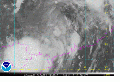
Some pictures of the typhoon have been acquired by the Hiwamari satellites from the Japan Meteorological Agency (JMA) on the 2nd of August as it gets closer to the coast.
To have a better look at the evolution of the storm on the 2nd of August, click on the following link: http://www.ssd.noaa.gov/PS/TROP/floaters/06W/flash-vis-long.html
