Overview of the Disaster and Objectives
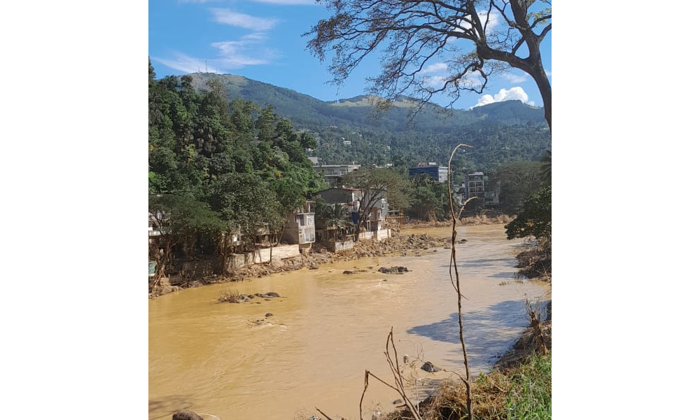
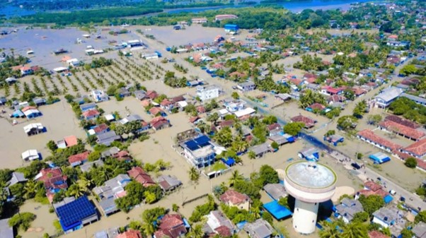
From late November to early December 2025, Sri Lanka experienced its most severe flooding in decades following the passage of Cyclone Ditwah. The system brought prolonged and intense rainfall, triggering deadly landslides in the central hill country and widespread inundation across 25 districts. According to the Joint Rapid Needs Assessment (JRNA) released on 02 December, the disaster has resulted in catastrophic impacts with 410 confirmed fatalities and hundreds reported missing. The assessment estimates that approximately 1.8 million people are living in areas exposed to flood risks, with critical infrastructure severely compromised.
Background and Context
The intensity of the cyclone caused widespread disruption to communication and transportation networks, creating significant "blind spots" for national authorities. In the immediate aftermath, the UNDP Sri Lanka office reported facing severe challenges in obtaining ground-level damage data due to these disruptions. Recognizing the urgent need for situational awareness to guide search and rescue and relief operations, UNDP requested support from UN-SPIDER for high-resolution satellite imagery and flood extent mapping.
Satellite-based Flood Analysis and Methodology
On 28 November, the UNDP Sri Lanka office contacted UN-SPIDER to request urgent assistance with flood maps, as ground teams faced severe restrictions due to inaccessible roads and severed communication networks. UN-SPIDER immediately facilitated collaboration with its China Regional Support Office (RSO) hosted at Wuhan University. Prof. Xi Li at Wuhan University coordinated a general emergency imaging plan, mobilizing the Spacety China commercial satellite constellation to acquire data within 24 hours of the request.
The analysis utilized Synthetic Aperture Radar (SAR) sensors, specifically from the Chaohu-1 and Sehnqi-02 satellites, acquired on the morning of 29 November 2025. SAR technology was critical for this operation as it allowed for clear flood detection through the heavy cloud cover associated with Cyclone Ditwah. The SAR data was processed by the research team at Wuhan University to delineate inundation zones across the affected river basins and coastal plains.
Results
The satellite-derived analysis revealed extensive inundation across 20 districts, with severe impacts identified in Gampaha, Puttalam, Mannar, and Colombo. The mapping successfully distinguished between permanent water bodies and flood-induced inundation, providing a precise view of the disaster's scale.
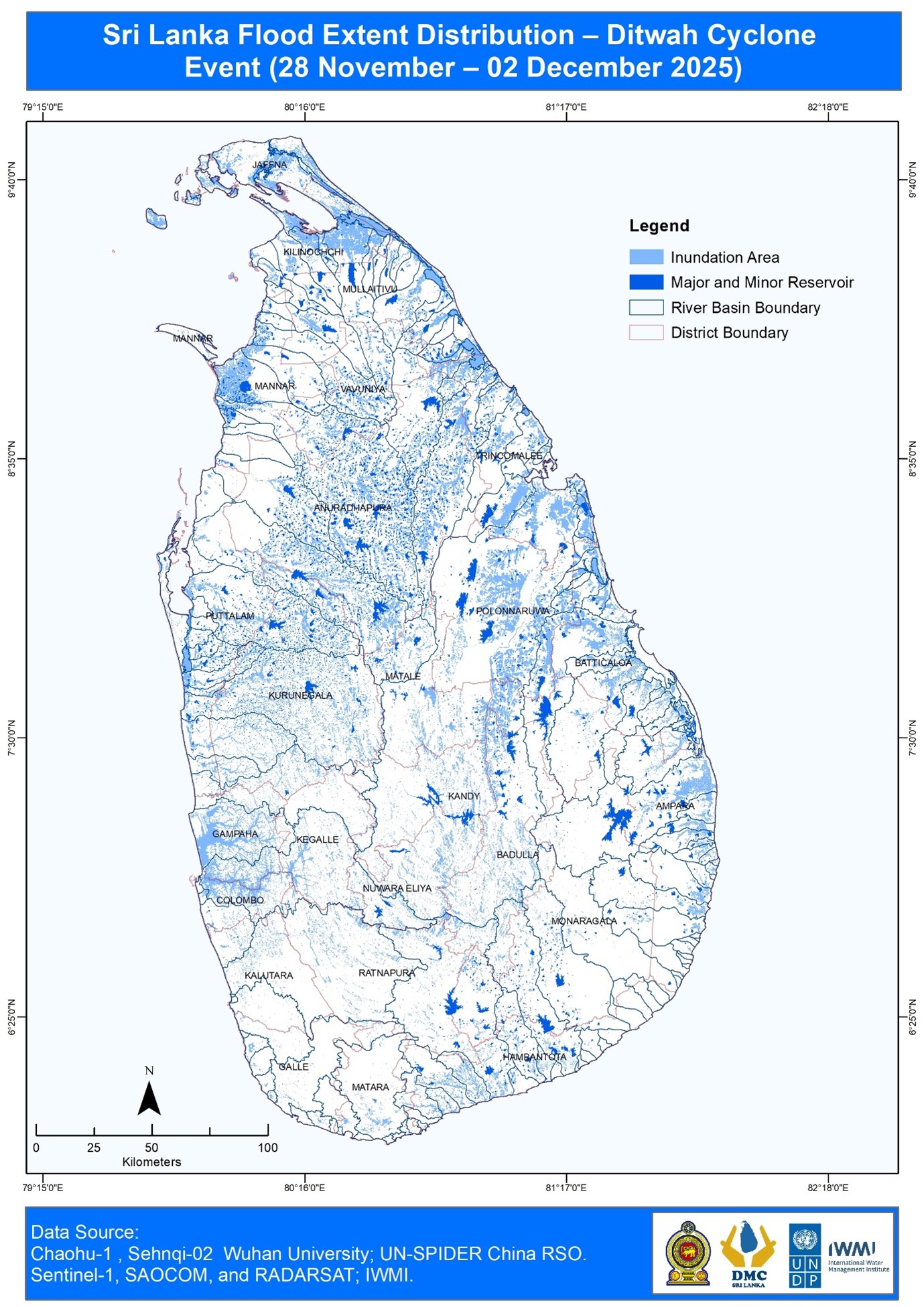
The flood extent products generated by Wuhan University were directly integrated into the national response framework:
- Situational Awareness: The maps were disseminated via the UNDP GeoSmart platform, allowing humanitarian partners to visualize the crisis and prioritize resource allocation to the most isolated communities.
- UNDP launched the Rapid Impact and Data Assessment (RAPIDA) platform to provide near real-time geospatial analysis to enable better-informed decision-making for response and early recovery planning and reconstruction. The RAPIDA consolidates official Government data, and satellite analysis to provide a clear, accessible picture of flooded areas, exposed populations, buildings, landslides, and multidimensional vulnerability at the divisional secretariat level. View the data insights: Sri Lanka Flood Analysis 2025 - UNDP GeoSmart
Implications for Response, Recovery, and Resilience
The speed of this operation, from UNDP's urgent email request to the delivery of actionable intelligence by the China RSO, demonstrates the effectiveness of UN-SPIDER’s bridging role. It validates the importance of pre-established networks between UN agencies (UNDP), specialized mandates (UN-SPIDER), and academic/technical partners (Wuhan University).
The seamless integration of this satellite data into the official JRNA report and RAPIDA underscores the necessity of Earth observation data in evidence-based humanitarian reporting. Continued collaboration will focus on refining these workflows to ensure that even in the absence of precise ground coordinates, satellite resources can be autonomously tasked to cover likely impact zones, further reducing response times in future climate emergencies.
Sources:
- ReliefWeb: "Sri Lanka: Floods and Landslides - Nov 2025", https://reliefweb.int/disaster/fl-2025-000213-lka
- WFP ADAM: "ADAM (Advanced Disaster Analysis & Mapping) - Flood Impact Analysis Sri Lanka (01 December 2025)", https://reliefweb.int/map/sri-lanka/adam-advanced-disaster-analysis-mapping-flood-impact-analysis-sri-lanka-01-december-2025