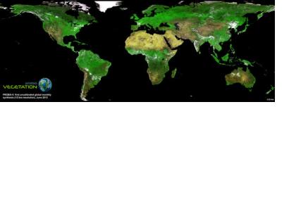
In the beginning of June, the first global map of vegetation from the recently launched Proba-V has been unveiled, demonstrating that the minisatellite is on track to continue a 15-year legacy of global vegetation monitoring from space.
Proba-V is the fourth satellite in the European Space Agency's PROBA series. It is designed to map land cover and vegetation growth across the entire planet every two days. The data can also be used for day-by-day tracking of extreme weather, alerting authorities to crop failures, monitoring inland water resources and tracing the steady spread of deserts and deforestation.
While still being commissioned, the satellite continued to acquire images that have been stitched together to give us the mission’s first, uncalibrated map of global vegetation – unveiled at the Probing Vegetation conference that took place from 4 to 5 July 2013 in Antwerp, Belgium.

