UN-SPIDER COMMENCES TECHNICAL ADVISORY MISSION TO KYRGYZ REPUBLIC — A STRATEGIC ASSESSMENT TO STRENGTHEN NATIONAL DISASTER RISK MANAGEMENT USING SPACE-BASED INFORMATION
Bishkek, 8 July 2026 — The United Nations Platform for Space-based Information for Disaster Management and Emergency Response (UN-SPIDER) Beijing Office, today commenced its three-day Technical Advisory Mission (TAM) to the Kyrgyz Republic, hosted by the Ministry of Emergency Situations (MES KR), in Bishkek.
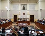
UN-SPIDER Contributes to International Dialogue on Satellite Data for Peace and Humanitarian Action at the Vatican
From 23–25 June 2026, UN-SPIDER participated in the Satellites for Peace: An Idea Whose Time Has Come conference at the Pontifical Academy of Social Sciences in Vatican City.
Earth Observation for Sustainable Development Goals (EO4SDG Book)
The 2030 Agenda for Sustainable Development, adopted by all United Nations Member States in 2015, is a shared blueprint for peace and prosperity for people and the planet.
The workshop will be hosted online via MS Teams on 23 June 2026. This event is restricted to Space4Water stakeholders, featured professionals, young professionals, and representatives of Indigenous communities featured on the portal.
The courses start on Jun 03, 2026, and will be available until Jun 30, 2030.
About This Course
The world is facing unprecedented challenges in achieving the Sustainable Development Goals (SDGs). Timely, accurate, and accessible geospatial data is critical for monitoring progress, making informed decisions, and driving effective action. This online course empowers participants to harness the power of Chinese Earth Observation (EO) satellites — a rapidly growing and increasingly vital resource — to address these challenges.
This course is designed for practitioners working in water resource management, climate change adaptation, environmental protection, disaster response, and urban planning; government officials, NGO staff, and policymakers seeking data-driven geospatial insights; researchers and academics in remote sensing, GIS, environmental science, and related fields; and advanced undergraduate or graduate students seeking practical skills in geospatial data analysis and SDG applications.
United Nations Platform for Space-based Information for Disaster Management and Emergency Response providing expertise in space-based information for disaster management and EO data usage for the SDGs
Wuhan University
Leading academic institution in China with a focus on aeronautics, astronautics, and remote sensing
UNU-INWEH
United Nations University Institute for Water, Environment and Health specializing in water-related research and capacity development
APSCO
Asia-Pacific Space Cooperation Organization promoting the development of collaborative space programs among Member States in peaceful applications of space science and technology
The world is facing unprecedented challenges in achieving the Sustainable Development Goals (SDGs). Timely, accurate, and accessible geospatial data is critical for monitoring progress, making informed decisions, and driving effective action. This online course empowers participants to harness the power of Chinese Earth Observation (EO) satellites — a rapidly growing and increasingly vital resource — to address these challenges.
This is event is available for participation on an ongoing basis
🌍 How can satellite data support climate adaptation efforts across Africa?
On 21 May 2026 at 1:00 p.m. UTC+2, the 4th edition of ClimateSCOpe will bring together partners and experts to showcase innovative initiatives using Earth observation and space-based technologies to strengthen climate resilience across the continent.