Across the globe, natural hazards have triggered widespread death and destruction, with the human and economic impact of disasters continuing to rise. Despite ongoing advancements in disaster risk governance and comprehensive risk management, Least Developed Countries (LDCs), Landlocked Developing Countries (LLDCs), and Small Island Developing States (SIDS) continue to experience devastating impacts, eroding hard-won development gains.
Since several decades ago, developed and developing countries began to implement early warning systems to reduce the impacts of natural hazards such as severe weather, floods, and tsunamis. In March 2015, 187 Members States of the United Nations committed to substantially increase the availability of, and access to multi-hazard early warning system as one of the targets included in the Sendai Framework for Disaster Risk Reduction 2015-2030.
Floods are impacting many communities around the world, triggering devastating disasters as in the case of the recent floods in Southern Brazil in May 2024, in the South Eastern United States in September 2024, and more recently in Valencia, Spain at the end of October 2024. Since several decades ago, early warning systems have been implemented to minimize impacts in case of floods and other hazards. Flood forecasting is one of the key essential elements of any flood early warning systems.
This is event is available for participation on an ongoing basis
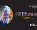
The launch event of the Atlas of the Human Planet 2024 will be an occasion to explore how information on population and human settlements derived from Copernicus satellites can help tackle a broad spectrum of societal challenges.
The geography of humans on the planet defines many issues of security, environment, economics and equality. The diversity of cities and rural areas also offers models for the change necessary to adapt to a changing climate and geopolitical landscape.
Researchers and academics; data providers; national and international public authorities addressing population, regional and urban policies; NGOs and anyone interested in the analysis of human settlements and its population.
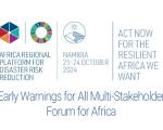
From 22nd to 24th October, more than 700 stakeholders involved in disaster risk reduction in Africa are gathering in Windhoek, Namibia, under the umbrella of the 9th Africa Regional Platform for Disaster Risk Reduction, to discuss how best to advance efforts to achieve the seven goals of the Sendai Framework for Disaster Risk Reduction 2015-2030.
This is event is available for participation on an ongoing basis
On 26 December 2004, an earthquake in the Indian Ocean caused a devastating tsunami that killed around 230,000 people in 14 countries. It remains one of the deadliest disasters in recent human history.
The people who lived through this tragedy are forever changed by it. That is why this year, World Tsunami Awareness Day (WTAD) is honouring the memory of the Indian Ocean Tsunami on its 20th anniversary and highlighting major advances on protecting people since.
From 20th to 24th October, the United Nations Office for Disaster Risk Reduction (UNDRR), the African Union Commission (AUC), the Southern African Development Community (SADC), and the Republic of Namibia are organizing the 9th Session of the Africa Regional Platform for Disaster Risk Reduction in Windhoek, Namibia.
On 15th October, the European Space Agency (ESA) officially kicked off their new project, Ciseres, at the International Astronautical Congress (IAC) in Milan. Ciseres is a small satellite mission integrating AI directly into the process of identifying relevant information in satellite imagery. Users are provided with rapid “actionable” information within just a few minutes.
“AI-powered Satellite systems will redefine how we respond to disasters” (CEO of Deimos).
This is event is available for participation on an ongoing basis
Synthetic Aperture Radar (SAR) has the capability to observe the Earth's surface both day and night and through most weather conditions, making it an ideal sensor to support a wide range of science and applications. Additionally, unique capabilities of SAR include its ability to penetrate through various mediums (such as vegetation, snow, and soil), measure surface deformation and small movements on the order of centimeters, and its sensitivity to structure and to moisture content.
Disaster response efforts benefit substantially from the use of information on the geographical extent of the hazard that triggered the disaster. For example, maps of the geographical extent of floods allow disaster managers to become aware of all the communities and assets that may have been affected.

")