1. Incorporation of GloFAS: GloFAS gives information on flood forecasts that can be used to minimize the impact of floods through its routine use in early warning systems. For this project, GloFAS will be utilized to obtain the potential location of floods in study areas for 2-, 5- and 20-year return period floods (respectively called Medium, High and Severe Awareness Levels). In addition, data from the reporting points included in GLOFAS will be used to provide additional information on the temporal behavior of floods in the study areas.
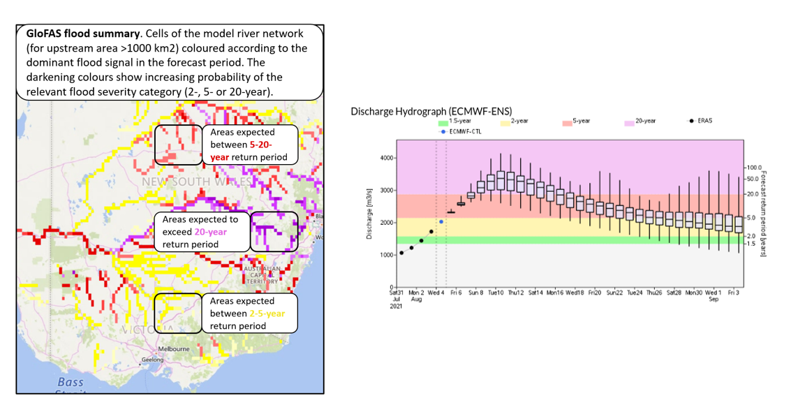
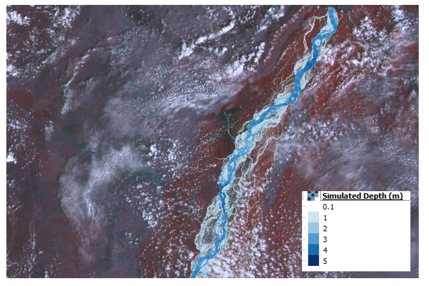
2. Hydraulic modeling: To model the temporal and spatial behavior of floods, open-source hydraulic modeling software will be applied. The software uses information of discharge in the channel, channel morphology, topography, and land-cover in the banks or shores of rivers. Data on discharge will be extracted from GloFAS reporting points. The hydraulic modeling for the three levels of floods in the selected region of rivers will provide maps of the geographical extent of floods.
3. Historical data collection: Data on impacts from historic floods such as potential impacts on communities, different sectors of development, and critical infrastructure will be collected. This data will be used to shape impact-based forecasts as part of the flood early warning system.
4. Vulnerability and impact assessment: Information on the vulnerability of exposed infrastructure and assets will be used to extract information on potential impacts.
5. Procedure development: Procedures will be developed that can be used by national space, disaster management, and hydrological agencies to incorporate the use of impact-based forecasts in flood early warning systems using inputs such as those provided by GloFAS and data provided by national disaster management and hydrological institutions.
6. Pilot implementation: The project will be implemented in pilot regions in Ghana, Guatemala, Nigeria, Peru, and South Africa.
The aim is to develop a framework that can be replicated in other countries and regions to improve flood early warning systems and minimize the impact of floods on vulnerable communities.