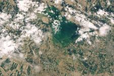
Satellites are capable of taking stunning images of the Earth from space. However, the data satellites capture goes beyond images and space based technologies can reveal information previously unseen.
Disaster managers and emergency responders can use the information satellites gather in all stages of the disaster management cycle. Reliable and timely information is essential when it comes to dealing with disasters, especially when infrastructure is hindered or made ineffectual. Space applications and space-based information provide this information in a number of ways. Remote sensing for Earth observation, satellite-based communication and global navigation satellite systems all contribute to more effective disaster management.
Before disasters occur, satellite information can aid disaster risk reduction by guiding urban planners and elaborating risk exposure. Infrastructure and road maps in rural regions frequently obtained from satellite images ensure that evacuation routes can be planned. Satellite data, for instance from meteorological satellites, can also be used to predict and anticipate disasters such as floods. Prior maps of exposed areas help identify where preventive measures need to be applied. During a disaster, space-based technologies provide disaster managers and emergency responders with information about incessible flooded or damaged areas, as well as enabling communication in emergency situations.
Satellite Technology
Earth observation satellites provide valuable data that can be used to track and monitor many types of natural hazards. They can be used to elaborate hazard, exposure and risk maps, as well as to map areas which have been affected by floods, tsunamis, volcanic eruptions, forest fires, landslides and other natural hazards.
Global navigation satellite systems (GNSS) are vital for disaster management as the global coverage of the signals provided by these constellations of satellites allows emergency responders to supply coordinates of landing sites to helicopter pilots in areas affected by disasters, even when local communication infrastructure is destroyed. They also help develop more accurate maps of disaster areas and facilitate interoperability of data and information. Global navigation satellite systems are also contributing to an improved understanding of the relative motion of tectonic plates.
Communication satellites are essential when there is a need to transmit messages very rapidly across vast areas. Disasters often leave local communication infrastructure incapacitated and disasters managers are unable to coordinate emergency response efforts. Communications satellites help the coordination and communication between disaster management agencies in the field and elsewhere for effective resources and policy decisions. They also offer the possibility of transmitting tsunami warnings very quickly from one continent to another, in addition to other relevant information. The Satellite Technology section provides further details about different types of satellites.
Emergency Mechanisms
To facilitate universal access for disaster management to space-based information, the international community has established a series of international mechanisms. Mechanisms such as the International Charter “Space and Major Disasters” and the Copernicus Emergency Management Service (EMS) support disaster management and emergency response operations through the provision of information products derived from satellite data to monitor the situation on the ground. UN-SPIDER promoted these international mechanisms among disaster management organizations in order ensure they have timely and relevant information when disasters strike. The Emergency Mechanisms section provides an overview of these mechanisms and their procedures and workflows.
International Asteroid Warning Network
The International Asteroid Warning Network (IAWN) is a virtual network linking together the institutions performing functions such as discovering, monitoring and physically characterizing the potentially hazardous near-Earth object population and maintaining an internationally recognized clearing house for the receipt, acknowledgment and processing of all near-Earth object observations. Recognizing the need to reach national disaster management agencies, IAWN has established links with the UN-SPIDER programme to raise their awareness about NEOs.
International Space Weather Initiative
Sudden bursts of plasma and magnetic field from the sun's atmosphere called together with sudden brightening of radiation, or solar flares, and high-speed solar winds could cause space weather effects here on Earth. Space weather events can produce electromagnetic fields that might damage space-borne and ground-based technological systems, such as power lines and navigation systems. ISWI is a programme of international cooperation to advance the space weather science by a combination of instrument deployment, analysis and interpretation of space weather data from the deployed instruments in conjunction with space data, and communicate the results to the public and students.
Space Technologies at the United Nations
The UN has also recognised the usefulness of space-based information and plays an important role managing and promoting their use. Many UN departments frequently use and benefit from the use of space-based information. This section provides provides a few examples.
User Stories
The user stories and case studies in this section provide anecdotal evidence of the usefulness and diverse application options that space-based information is able to offer. They address a wide range of application examples.

